View Baden Powell Lynn Canyon to Grouse Description | Add Comment
Lori from Vancouver writes:
I did this stretch today, Lynn Valley to the top of Grouse (BP to Old BCMC to BCMC). Took 3hr 15min. Conditions were great.... Dry and cool.
I carried cleats per previous posts but there is longer a need to. Just a bit of snow right at the top of Grouse (around 125 marker) totally manageable with careful footing. I suspect it will be melted very soon.
Posted: March 21, 2019 06:26:02 PM PST
Louise from North Vancouver writes:
I did this trail Saturday March 16th, however I started from Capilano University, followed Lilloot Road, cut across Rice Lake Road and joined the Baden Powell off Lynn Valley Road. The trail starts well but as you get higher, it is covered in compacted ice and is VERY SLIPPERY! I had my Salomon Speedcross4 trail running shoes and I found myself constantly grabbing on to tree roots/rocks to stop myself from falling. I slipped at least 10 times. If you are going to do this in the winter months (even now at the tail end of winter) I would seriously recommend spikes or at least something with more grip. You also have to really pay attention to the markers - I found myself losing the trail on more than one occasion.
I covered 15km in total with a time of 3h17min (no break - I was fighting the fading light - I started hiking waaaay later than I should)
I gave it 4* because in warmer months, this would be a lovely hike.
Posted: March 18, 2019 01:33:10 PM PST
Alana from Port Coquitlam writes:
Did this stretch of the trail yesterday. I'd say 85% of the trail is still covered in ice/compact, extremely slippery snow. I had studs on my boots and hiking poles so I didn't slip. But others in runners were having a bad day. I advised them to to around, but no one did. Even with the ice I still made it in good time - 4.5 hrs, including a stop at the metal bridge for lunch.
Posted: March 17, 2019 01:24:37 PM PST
Ana B. from North Vancouver writes:
Did this hike on Saturday, October 6. Perfect sunny Fall day. We started our hike in Grouse Mountain and finished in Lynn Valley. Very beautiful trees. Trail very well maintained. Kind of said when it was finished and had to go back to civilisation. :) can’t wait to put my hiking shoes again...
Posted: October 8, 2018 07:29:28 AM PST
Jacky from Vancouver writes:
Just did this from Grouse to Lynn Canyon. 3.5 hours with a little break in the middle. Very quiet hike, saw about 5-6 people along the way. Easy most of the way, a few steeper bits but nothing that will sore you out. There is a few trees to climb over. Some sections are not really maintained as its sort of a free hike but markings are pretty clear.
Posted: July 15, 2018 10:18:22 PM PST
Elena Domnina from Canada writes:
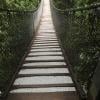
Awesome trail and freat workout. Crossing the suspension bridge at Lynn Canyon was my favorite. I hiked from Deep Cove to Skyline. Although, finished last 3 hr in complete dark- the trail is well marked, just need to keep attention to markers. Got a bit confused at the Skyline though. Heard a loud owl sounds.
Posted: February 5, 2018 10:43:16 PM PST
Sean from Vancouver writes:
Trail was ok. Started at Lynn Canyon, and headed towards Grouse. The gate people complain about is on the Grouse side, not the Lynn Canyon side.
Tracked activity on my phone, and it said the whole shebang was 9.27km with 506m elevation gain, including the road up to the stairs. The middle of the hike was pretty easy, but the beginning and end are quite steep.
In particular, the end of the trail near Grouse has very different and rugged terrain, with clearly visible trail markers but not clearly visible pathways. Two sections around this part require you to traverse across about a 2ft-wide stream - not sure if this is intentional.
Posted: May 21, 2017 03:57:34 PM PST
Alex from Laguna Beach writes:
Gorgeous hike, started at Deep Cove and finished at Lynn Canyon. It was a Saturday and there were a fair number of people up to Quarry Rock, but most (95%) people seemed to turn around after they reached it.
The trail was fairly well marked, but make sure you look out for sign posts (which can sometimes be slightly small) and watch out for the orange markers on trees, if you've gone more than 200ft w/o seeing one, stop and re-evaluate.
There are some areas that can be a little rough on the ankles (ie loose/slippery rocks) if you are prone to injury, take extra care.
Overall beautiful hike, from the way it looked, it seems like it would be easier to start from the Lynn Canyon side, but the reward of reaching the river at the end of your hike (if you start at Deep Cove) is much more gratifying.
Posted: March 20, 2016 11:02:23 AM PST
Kitsilano from Kitsilano writes:
The idiots are still keeping the gate locked and preventing people from using this trail.
Posted: February 22, 2016 06:02:21 PM PST
Diane from North Vancouver writes:
Large pile of tree debris gathering just above BP trail at 2nd crossing of McKay creek going east!
Posted: February 8, 2016 12:14:23 PM PST
Nicola from Vancouver writes:
I did this hike combined with the Deep Cove to Lynn Canyon today. I took the bus from downtown Vancouver to Phibbs Exchange then another to Deep Cove. Painfree and fast. For my return I took the bus from Grouse to Lonsdale then hopped right onto a seabus.
I wore hiking boots for this and was glad of them in the later stages (Fromme & Grouse) when the trail was pretty gnarly - lots of roots & rocks - so good ankle support helped me especially as I was obviously more fatigued here. There were a few patches of mud but nothing too taxing.
There are enough up's to get a sweat on - up from the Lynn Valley Road makes me reminisce about one of a few "kill me now" moments.
Not so much in terms of views bar Quarry Rock and the occasional peek through the trees if that's what you're looking for. I really noticed the changes in flora as I went through several different forests on the different mountains especially the trees. That was really quite wonderful.
The crowds (though minimal as it was midweek) were unsurprisingly at Quarry Rock and Lynn Canyon but not enough to bother me - a school group kindly moved out of my way as I headed up to Quarry Rock.
Parts of this trail are also shared with mountain bikers although I only came across one with his dog on Mt. Fromme, but keep your eyes peeled.
The trail is pretty easy to follow - just keep your eyes out for the BP markers with the fleur de lys as well as signposts dotted along the way (you can also access it on your google maps). The comments about not being able to locate the trail and heading up to Powerline did not happen to me - the trail was well marked here (may be new?)
You will have to meet up with the trail again along the Lynn Valley road from where you come up from Lynn Canyon. You can detour through the streets to meet back up with it further along but that, in my mind, kind of defeated the purpose.
A great hike!
Distance: 15.03 miles/24.19km
Time: 4:26:04
Elevation: 1707 ft
Posted: May 6, 2015 09:09:50 PM PST
Jenn G from Burnaby writes:
April 8, 2015: McKay Creek bridge is still out. I don't know what bridge Caroline is talking about, but the one on this particular trail has been swept away. Use caution when crossing :-)
Posted: April 10, 2015 01:41:24 AM PST
Jenn G from Burnaby writes:
Hiked with a good pace and completed in just over 2 hours with a couple of pit stops along the way. At one point the bridge was out crossing a creek but careful manoeuvering made it possible. Early April there were some wet sections but if you're out that deep in the woods on the North Shore you should expect it! Few people on this trail until the end at Grouse Mountain where it meets with the Grind. Loved it!
Posted: April 10, 2015 01:34:11 AM PST
Lynna from Delta writes:
We did this trail today, March 20, 2015, from Grouse Mountain to Lynn Canyon. It took about 2 1/2 hours to get to Lynn Headwaters (which is where the description says to go), but because the title says Lynn Canyon, we walked the extra 25 - 30 minutes down to the suspension bridge. We were carrying day packs (about 10 lbs each) as well, and are in reasonable shape. We did not jog the trail at all. Just walking.
I know that the gate is closed at the start of the Grind, blocking the regular entrance to the BP trail, but if you park in the gravel parking lot you will see plenty of ways to get around the fence. The fence doesn't go that far. We walked a little further east in the parking lot and just walked up a trail there. It put us right at the junction point for the BCMC.
I think this hike is nicest at Grouse Mountain. The terrain is more varried, and you don't feel as close to the houses as you actually are. Once you get past that area it opens right up, with a labrynth of biking trails. Just make sure you look for the markers, and not just follow a path. Otherwise, it's very simple to navigate.
We were there on a Tuesday, and still saw a reasonable number of people. Still it wasn't very busy. Technically we saw more dogs than people.
We took the bus from Lynn Canyon (we walked down Lynn Valley Rd to Mountain Hwy and had a coffee at Starbucks, then caught the bus) to Lonsdale, then took the bus back to Grouse.
Posted: March 10, 2015 05:57:02 PM PST
Lynna from Delta writes:
We did this trail today, March 20, 2015, from Grouse Mountain to Lynn Canyon. It took about 2 1/2 hours to get to Lynn Headwaters (which is where the description says to go), but because the title says Lynn Canyon, we walked the extra 25 - 30 minutes down to the suspension bridge. We were carrying day packs (about 10 lbs each) as well, and are in reasonable shape. We did not jog the trail at all. Just walking.
I know that the gate is closed at the start of the Grind, blocking the regular entrance to the BP trail, but if you park in the gravel parking lot you will see plenty of ways to get around the fence. The fence doesn't go that far. We walked a little further east in the parking lot and just walked up a trail there. It put us right at the junction point for the BCMC.
I think this hike is nicest at Grouse Mountain. The terrain is more varried, and you don't feel as close to the houses as you actually are. Once you get past that area it opens right up, with a labrynth of biking trails. Just make sure you look for the markers, and not just follow a path. Otherwise, it's very simple to navigate.
We were there on a Tuesday, and still saw a reasonable number of people. Still it wasn't very busy. Technically we saw more dogs than people.
We took the bus from Lynn Canyon (we walked down Lynn Valley Rd to Mountain Hwy and had a coffee at Starbucks, then caught the bus) to Lonsdale, then took the bus back to Grouse.
Posted: March 10, 2015 05:25:39 PM PST
Kitsilano from Kitsilano writes:
This is getting annoying. Since December, the gate has been locked. Who are the idiots that are locking the gate? This trail is a year round trail. Can't they move the gate further up to where the grouse grind trail really begins. Seen so many people show up and leave because they can't access the Baden Powell trail. Idiots.
Posted: February 25, 2015 10:25:06 AM PST
Caroline Chao from North Vancouver writes:
The bridge over Mackay Creek on the Powerline Trail is repaired. I was there yesterday.
Posted: January 30, 2015 08:29:43 PM PST
Kate from Port Moody writes:
Thanks for the bridge status update, I plan to hike this section tomorrow and was waiting for an update ;)
Posted: January 19, 2015 11:49:43 AM PST
Outdoor-Clan from Regensburg, GER writes:
I hiked this section of the Baden Powell Trail today and crossing the East Mackay Creek was not a problem. The bridge is gone indeed, as mentioned by Scott, but if the water levels are low, it is no problem to get to the other side. It took me literally three steps from one side to the other. Of course, caution is necessary if water levels are higher. Also be warned that some stones in that section might be pretty slippery. Apart from that, I did not encounter any other problems on this part of the trail.
Overall, I needed 2h 45m for the 12km from the Lynn Canyon suspension bridge to the Grouse parking lot.
Posted: January 17, 2015 08:12:03 PM PST
Rosemarie from Vancouver writes:
What is the status on the bridge?
Posted: December 6, 2014 11:53:41 AM PST
Scott Jones from North Vancouver writes:
Further to previous comment: the east bridge ON THE POWERLINE, that crosses the east fork of Mackay Creek was hit by the debris flow and is not crossable at this time.
Posted: November 5, 2014 02:14:13 PM PST
Scott Jones from North Vancouver writes:
As of November 4, 2014, the bridge on the middle creek crossing (Mackay Creek) was entirely taken out by a debris flow. Both horizontal logs - as well as the tree that spanned the canyon 30 metres above the water - are simply no longer there.
Crossing the creek now means rock hopping in the creek and therefore depends upon water levels. I'd definitely recommend you check the amount of precipitation before proceeding, and stay away if it's been raining a lot for the time being.
Additionally, the east bridge that crosses the east fork of Mackay Creek was hit by the debris flow and is not crossable at this time.
Posted: November 5, 2014 02:10:07 PM PST
Steph from Vancouver writes:
I went west - east this morning and thought it was a great mix of trickier sections and easier sections. I found it well-marked. The signposts disappear closer to Grouse, but there are plenty of orange 'BP' triangles and plain orange squares.
My hike didn't start on a great note, and it had nothing to do with the trail. I've never done the Grind and wasn't 100% sure if I should start Baden Powell through the same gate. I asked staff at Grouse Mt. and they said that they wouldn't give any information about Baden Powell or the BCMC. Just a warning that you might not want to depend on Grouse Mt. for advice :)
Posted: August 10, 2014 05:05:00 PM PST
Clovis from Jaragua do sul writes:
I did this trail last Sunday and took me 2h20min.
I had issues to find its entrance on Lynn canyon (took me half an hour to figure it out).
Be prepared to have a hard time on the last two kilometers (when it reaches Grouse mountain), because it gets rocky and steeper.
Posted: June 12, 2014 05:06:58 PM PST
Van hiker from Vancouver writes:
This is a great hike to start at Grouse mountain. Did it beginning of May. The gate was closed but unlocked. Just push it open and ignore the closed trail signs and keep to the right. The first 1km is steep but levels off and remaining 9km is very pleasant walk in the forest. Near Lynn valley there will be some mountain bikers sharing the trail. This is great trail at any time of year. It takes about 3 hours.
Posted: June 2, 2014 10:25:28 AM PST
Barnes from Burnaby writes:
@Susan Following the Powerlines to Skyline and then walking up Skyline to access the Baden Powell is one option. A better option is if you walk along the parking lot, on the left before it narrows, you can follow a path from there up and access the Baden Powell. It's basically at the end of the row of cars parked closest to the mountain. I don't believe the trail is marked, it's just there from lots of others using it.
It's annoying that the fence has blocked the Baden Powell for several years now. I've hiked that section of Baden Powell since the early 90's and it's generally accessible all year. It's a nice loop to do in the winter from Grouse to Skyline, then returning via the powerlines.
Posted: March 25, 2014 11:11:20 PM PST
Susan from Vancouver writes:
Did this trail from west to east Sunday. Got little frustrated at the Grouse base looking for an entrance to the trail, since Grouse grind is closed till May, the access to Baden Powell is closed too. Have asked the staff at the guest service, was told the Baden Powell trail is not their property, so they dont know how to get there. Wandered around for about 30 mins and finally found out that the parking lot next to the gated trail entrance is connected to the Powerline Trail, and the Powerline Trail leads to the Baden Powell Trail via Skyline Rd. Not sure how people can reach the Grouse base coming from east, but hope this helps. Will try to write to Grouse Mountain management company to ask them put up a sign at the gate at least. The rest of the trail was nice enough to make up for this unpleasant start.
Posted: March 25, 2014 04:30:25 PM PST
Alex from Vancouver writes:
One of the best hike I've done on the North Shore (that can be reached by public transit).
The trail was very clear, and we never had to pull out the instructions since we just kept walking until we hit the Grouse Mountain parking lot.
Yes, there aren't any city view on this trail, but the sheer gorgeousness of the forest more than makes up for it.
Add that to a perfect mix of elevation gain, and this was a perfect weekend hike!
Posted: July 14, 2013 11:44:03 AM PST
Molly from Vancouver writes:
Did this trail today (Lynn Canyon to Grouse). First off, I would point out that from the bus stop at Dempsey Road it takes 1.1km to get to the stairs. There is a sign there at the bus stop but it was a small shock after not reading it on here!
Saw some woodpeckers not long into the trail too which was nice. I would disagree with another poster here saying that its more difficult east to west. I prefer going uphill, it's easier on the knees, but I guess that's personal preference. I do agree that the part just before Mosquito Creek where it cuts through the forest for some time with a very steep drop on the left was challenging, though with practice I'm sure it's easier, a couple of people flew by me at that part!
The rocky part right near the end I found to be hard on the knees and tiring, but I'd still rather go that way than to go the other way and have too much downhill.
At the end in regards to the gate that keeps people off the Grind, it is closed but not locked. So if you are going west to east and arrive to find the gate closed, just open it.
Took just under 3hrs, and no getting lost!
Posted: March 27, 2013 04:11:09 PM PST
Eua Na Chiangmai from Surrey BC writes:
Did this trail yesterday... an amazingly gorgeous day for mid-February in the Lower Mainland, full of Sun and reasonably worm (on the trail).
As a runner, I find this trail to be a great balance of beauty, tranquility and difficulty... it's by no means an easy trail due to its distance (round trip) and there are some technical sections there the last few KM towards Grouse base. But none the less, it's a beautiful trail filled with big trees to disappear into, well canopy and beautiful flowing creeks... a perfect way to enjoy nature while for avid trail runners; to digging deep pushing yourself and keep cool... just watch out and share the trail with bikers ;)
This is one of my favorite trail to run on, well mark and maintain all year round (I know this cus, I've been running this tail couple of times a month for the past year and a bit) will not disappoint... Just be sure to keep track of the "BP" markers on trial and you'll sure to have an awesome day.
It's a must!!!
Posted: February 16, 2013 11:14:04 PM PST
Georg from Vienna writes:
After doing the first leg last year, I hiked from Lynn Valley to Grouse base today.
Once you've found the trailhead (if you take the bus, just keep straight on the road to the parking lot, no matter what everybody tells you) this is a really nice trail, which is satisfyingly challenging without being treacherous.
The last part, however -- the 2 kilometers from Skyline to Grouse Base -- is very unpleasant, as a misstep can have ugly results. The slope is steep, there are many roots, rocks (some unstable) and the width of the trail itself is not exactly forgiving. Also, if you go East to West, you might be tired by that point, which adds to the risk.
I still enjoyed it -- a lot, actually -- but that last part is a marked difference from the rest of the trail
Posted: September 16, 2012 09:02:26 PM PST
Sasha from Port Coquitlam writes:
Did this hike today for the first time with my 6 year old daughter and hubby. Started at Lynn Canyon Park and worked our way towards Grouse. Got a little confused a bit in the beginning (after taking the bunch of stairs and up a steep-ish hill) and ended up on the road. We then found ourselves walking through some residential area before we found our way to the trail again. Some nice residents directed us (along with a few other hikers that lost their way as well) to Mountain View Park and we were back on the trail the rest of the way. We didn't think to bring a map or directions. Woops.
The first 1/2 of the trail was great and perfect for my daughter. Just had to watch out for a few Mountain Bikers racing through. However, after we hit Skyline drive it got a bit more technical. Some of the drop-off's made me a bit nervous taking her through especially when the trail was more sideways than flat. We had to hold her hand constantly. There were some steep areas where she lost her footing and wiped out. All the dry weather we've been having has made the ground a bit more unstable. I fell once as well. Probably would have helped if we were wearing trail shoes instead of crappy runners. :) We were also trying to pick up the pace due to the gate closing at 7PM (at the base of the Grind) and we wanted to get there in time. Luckily we did with 45 minutes to spare. Took us around 5 hours with a few stops for lunch/snacks/rest. There is only one part that you could really see a view of the city, but being surrounded by gorgeous nature and trees was good enough for me.
From Skyline to Grouse, I wouldn't bring a child under 8 years old or taking someone with 'height vertigo' due to a couple of areas that had narrow/single track, steep, slippery terrain. It could be potentially dangerous if you don't keep a continuous eye on them. Otherwise, it's a really great, very well-marked hike and totally recommend it. :)
Posted: August 6, 2012 11:27:20 PM PST
Vancouverite from Vancouver writes:
OK so I did this hike about a decade or so back. I seem to recall a log you had to carefully cross over a canyon; the hike taking far longer than 5 hours, and us ending at the TOP of Grouse mountain after going around Goat mountain. Am I missing something?
Posted: June 27, 2012 01:23:19 PM PST
Richard from North Vancouver writes:
Did this route from west to east on April 22 2012. Totally clear, very busy with mountain bikers and other trail walkers/ runners, particularly as you get closer to Lynn Canyon.
Two notes on the route... first, there is a big difference between west-to-east and east-to-west. I have done east-to-west previously, and found it much harder. This time, it was a breeze. It took me slightly under 2 hours from start to finish, and there are really only 2-3 uphill portions in this direction. If you're thinking of trying it out for the first time, perhaps start at Grouse.
Second, unfortunately the goofs at Grouse, in their zeal to keep people off the Grouse Grind in the winter season, have completely closed off all access to the trail head near the Grouse parking lot. It's kind of frustrating because they could have chosen to move the fencing further up the slope to allow unobstructed access to the Baden Powell, but I guess they took the easy way.
Anyway, if you arrive and find it closed off, the two easiest options are (1) take the Power Line trail a short distance east and find the rough trail leading which serves as a lead-up to the BCMC, the parallel Grouse trail. Or, if you can't find that, just take the Power Line trail all the way to Skyline Drive, where it's easy to locate the Baden Powell.
Boo Grouse!
Posted: April 23, 2012 09:14:38 AM PST
Suzanne from Vancouver writes:
Did this trail today and it was a lot of fun! The route was quick - only 2h30min. The trail seems to disappear regularly which made it quite exciting. The markings (orange tags on trees) were very clear though and kept me on track the whole way. My feet were absolutely soaked by the end as there was a lot of water, puddles and flowing water, on the trail.
Posted: February 22, 2012 03:43:27 PM PST
Penny from Vancouver writes:
My boyfriend and I hiked this trail on September 18 and despite the wet weather it was a really good hike. There are a lot of stairs at the beginning and the trail is well maintained turning into rougher terrain towards the end. This made the trail more challenging but still manageable for intermediate hikers. Reading the previous review before we left we were concerned about finding our way at the end. However, we found there to be numerous orange Baden Powell markers throughout the whole trail and had no problems. There are different trails off of the Baden Powell and several mountain biking routes so just ensure you follow the orange markers to make sure you stay on the Baden Powell. Including the initial walk from the bus stop to the trailhead and a lunch break this hike took us just under four hours.
Posted: September 21, 2011 10:01:19 PM PST
Aurelie from Vancouver writes:
I hiked this trail today. I was alone and everything was perfect at the beginning. Very quiet, well marked and the "up and downs" made it a really nice physical hike. Unfortunately, towards the end, there were no markers anymore. I could'nt figure out which way to go and found a couple that was lost as well. They followed a different trail and when they got to where I was, they were no more markers o_O. We decided to call a ranger for none of us had a GPS and it was getting late. The ranger couldn`t give us any useful information. It took 3-4 different calls to different people who told us that "Yes they did "set up" the trail but no they have no idea what the end of the trail looks like" so Good luck to us.
We ended up going down, trusting the information we printed before leaving and finally got to the road that leads to the base of Grouse Mountain
This is when the Ranger called us back to ask us how we are doing o_O
Posted: August 25, 2011 07:39:15 PM PST
Jared from Vancouver writes:
This portion of the Baden Powell has a great mix of difficult spots with enough level ground to let you catch your breath.
My wife and I did this hike with a friend on Aug. 21/11. With a few minor exceptions, the trail was very well maintained and we had a great time. Easy transit access is also a bonus.
I did a full write-up on our experience at:
http://jaredhunt.ca/2011/08/24/baden-powell-from-lynn-valley-to-grouse-mountain/
Posted: August 25, 2011 11:15:38 AM PST
JJ from Ottawa writes:
Just did this trail in the pouring rain. Thankfully the dense forest provides enough of a canopy so you don't get drenched immediately. The first section from Lynn Canyon is one of the most spectacular trails I've ever been on.
As an avid trail runner, this trail only took me 1hr 40 mins without stopping. The first and last sections are too steep to run, but most in between is run-able. A word of caution on the last section to Grouse. The single-file path is rocky and extremely steep. Very important to pay more attention to footing.
Also to note, according to my GPS watch, this trail was only 7kms.
Posted: July 14, 2011 03:32:01 PM PST
Sean the bear from vancouver writes:
I did this trail just today. it was very good. the trail was very much dried and nice. it took me about 4 hours from Lynn valley to Grouse mountain in returned. I will hike this trail again for sure.
Posted: June 10, 2011 04:18:09 PM PST
Rashmi from Vancouver writes:
I hiked this trail day before yesterday with my boy friend. This hike is really good with some steep sections and flat stretches. There are many creeks and they are full of water now itself. I could see some snow patches as well. If you like the sound of water in tranquil forest , then this hike is for you. Its a good warm up hike for the season . Go for it :-)
Posted: April 11, 2011 12:10:20 PM PST
Have you hiked Baden Powell Lynn Canyon to Grouse? Share your experience with us:
Comments that gratuitously attack or demean individuals or organizations are not acceptable. We reserve the right to remove comments or any other content we deem unacceptable in our sole discretion, including removing user names and profile pictures. For our full website terms and conditions including our legal guidelines for user postings and comments on www.vancouvertrails.com, please see our Terms of Use and Privacy Policy.




Andrija from North vancouver writes:
Mountain bikers on the Baden Powell are rude and agrassive , no respect given to hikers, they should be banned from the trail
Posted: April 28, 2022 08:38:35 PM PST