- Difficulty Easy
- Time 0.5 hours
- Round-Trip 1.6km
- Elevation Gain 50 meters
- Season March - November
- Camping No
- From Vancouver 2 hours, 30 minutes
- Public Transit No
- Dog Friendly On-Leash
Located along the mighty Fraser River, Alexandra Bridge served as an important link connecting the Cariboo region to Fort Langley. Today, the old Alexandra Bridge (the 2nd one built) provides a place for visitors to the area to stop and see an important piece of history in the area while also enjoying the incredible views of the Fraser Canyon.
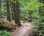
The trail is a short hike downhill to the bridge from the picnic area in the Provincial Park. From the sign at the start of the trail near the parking lot, follow the path into the forest as it descends and, within a couple of minutes, arrives at an old road. This was the old road that was used to access the bridge. Go left and follow the old road downhill.
The road goes through a switchback and then crosses some train tracks. Be cautious at the tracks as they are very active with plenty of daily freight trains passing through the valley each day. Continue following the trail as it goes down, rounds through a switchback to the right, then one final straight away to the bridge.
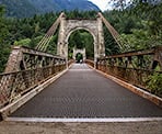
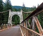
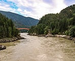
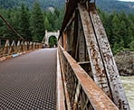
Walk out onto the old bridge with it's metal grates that provide a view of the fast rushing Fraser River below. As you walk across the bridge and look down stream, you can see the bridge that is in use along the Trans Canada Highway today. On the far side of the bridge, some of the cement structures stand and there is an opportunity to see the thick cables that hold the structure in place.
Return to the parking lot by following the old road back uphill, crossing the train tracks, then walking back up the trail to the right.
History
The Nlaka'pamux and Sto:lo First Nations have lived for thousands of years along the Fraser Canyon. There is evidence that an early bridge was built by local First Nations as a way to access important fishing areas along the Fraser.
There were plans in the 1840's to connect New Caledonia with Fort Langley. New Caledonia refers to the central and northern section of current day British Columbia before BC became a Province in 1871. The area was a district of the Hudson's Bay Company, used for fur trading, and the original need was to build a trail connecting this region to Fort Langley, which was an important trading and shipping hub at the time.
In 1858, a ferry service was established that connected the east and west shores to be used throughout the Gold Rush era. With more people flocking to the area during this period, it was a clear that a bridge was needed.
Led by Joseph Trutch, the first road bridge was constructed in 1861 and was part of the Cariboo Wagon Road that stretched from Yale to Barkerville. The construction of the road through the Fraser Canyon was a difficult task and, at the time, a major engineering feat. Much of the difficult and dangerous work along the route was done by First Nations and Chinese workers, many who lost their lives. The bridge was named after Princess Alexandra of Wales.
The Fraser Flood of 1894 destroy the original bridge and the structure was never rebuilt. In the 1880's, the Canadian Pacific Railway was built through the treacherous sections of the Fraser Canyons and several sections of the Cariboo Wagon Road were used for the tracks.
In the 1920's, the rise of the automobile saw the Province of British Columbia invest in the construction of the new Cariboo Highway through the Fraser Canyon. The second Alexandra Bridge was built across the river, enabling vehicle traffic to pass through the area. The suspension bridge is still the same one that exists today today, although it was closed to traffic in 1964 after the Ministry of Transportation built the third Alexandra Bridge.
Alexandra Bridge Provincial Park was established in 1984 to provide access to the second bridge. The park provides a timely location for a rest along the driving route through the Fraser Canyon and the trail is just 500-metres in each direction. The bridge provides some magnificent views of the rugged canyon below as well as the steep cliffs that makeup the area.
How to get to Alexandra Bridge
Estimated Driving Time from Vancouver
2 hours, 30 minutes
The Alexandra Bridge is located about 20km north of the town of Yale, BC, along the Trans Canada Highway in the Fraser Canyon.
From Vancouver, drive to Highway #1 and enter the highway heading eastbound. Begin the long drive through the Fraser Valley, passing through Abbotsford and Chilliwack. As you approach the town of Hope, take Exit #170 to continue on Highway #1 heading to Cache Creek.
After exiting at Exit #170, go left at the lights then continue straight through the next set of 4-way lights, passing through Hope, BC. Continue following the highway as you leave Hope and head north to Yale, BC.
As you pass through Yale, zero your odometer and drive for about 20km. Just after crossing a large bridge, Alexandra Bridge Provincial Park will be on your left.
It is not recommended to turn left into the parking lot because you are on a highway that has double lines with fast on-coming traffic. Just beyond the park, there is a works shed with a large gravel area. Pull into the gravel area and then when it safe to do so, come drive back onto the highway heading south, and then you can turn into the parking lot at the park.
View a map of Driving directions to Alexandra Bridge.

Although we try to keep information as current as possible, www.vancouvertrails.com makes no warranty or representation as to the availability, quality, fitness for purpose, conditions or accuracy of the information provided with respect to this trail or trails. The information provided herein is further subject to our Terms of Use.

Comments
Add Comment View All Comments