- Difficulty Easy
- Time 1.5 hours
- Round-Trip 5km
- Elevation Gain minimal
- Season year-round
- Camping No
- From Vancouver 1 hour
- Public Transit Yes
- Dog Friendly On-Leash
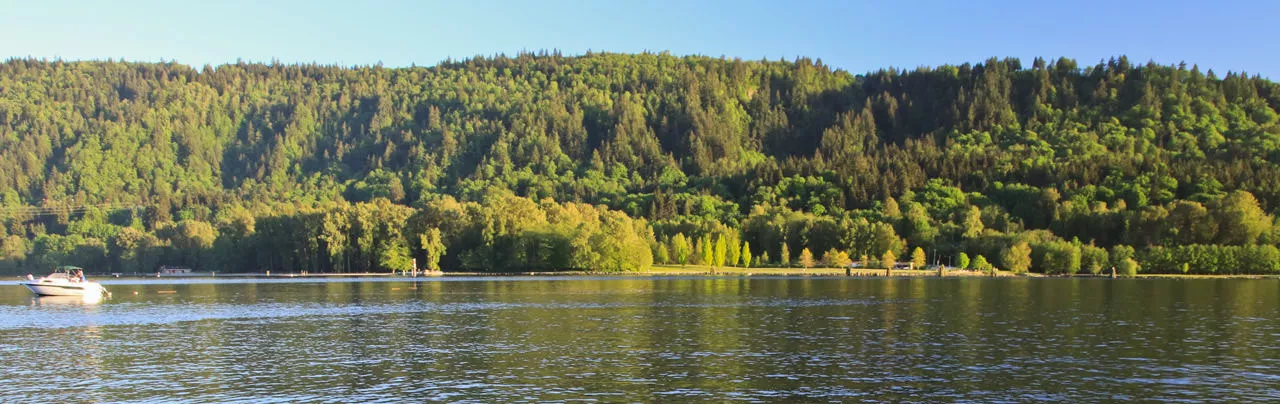
Located in Belcarra Regional Park, Admiralty Point is a short hike that offers spectacular views of Deep Cove, Mount Seymour, and Burnaby Mountain across the waterways connecting Burrard Inlet with Indian Arm. The trail has very little elevation change and is perfect for families.
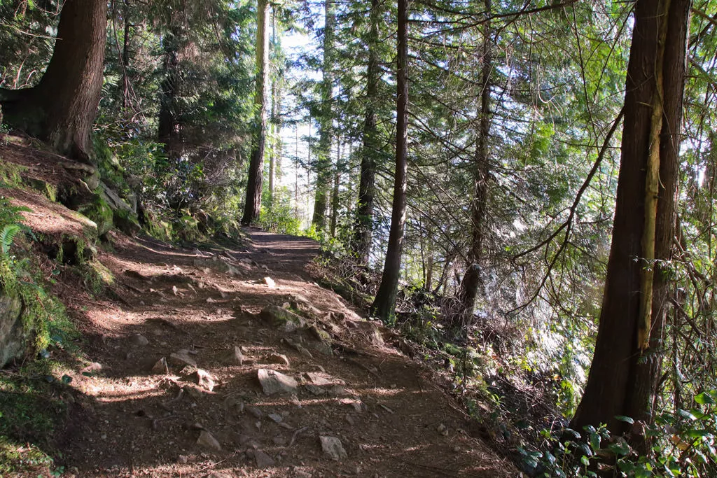
From the parking lot facing the water, walk towards the public bathrooms and follow the paved path towards the beach area. Before reaching the beach, a small sign on your left points in the direction to Admiralty Point. Follow the dirt trail into the forest and away from the crowded park area.
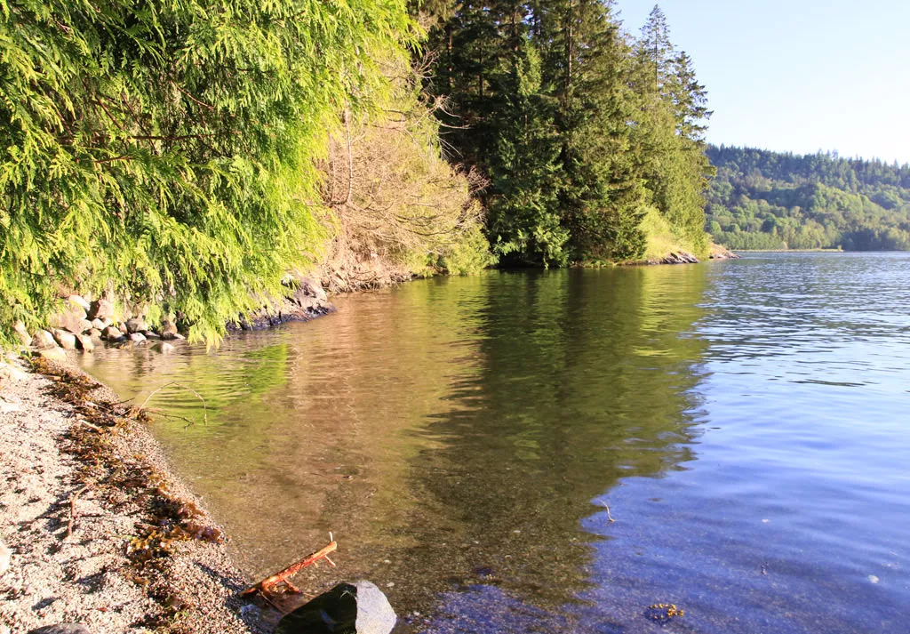
Shortly after walking on the dirt trail, you arrive at a gravel road which is actually a driveway for one of the houses in the area. Cross the driveway and follow the trail as it begins to ascend. The short hill begins to level out very quickly and then follows a short flat section before descending back downhill where the water becomes visible through the trees.
The trail continues along the shoreline, offering glimpses of scenery and the passing boats on a warm summer's day. The trail eventually reaches a sign pointing the way to Cod Rock. This is a short side track with a view worth checking out before continuing along the trail.
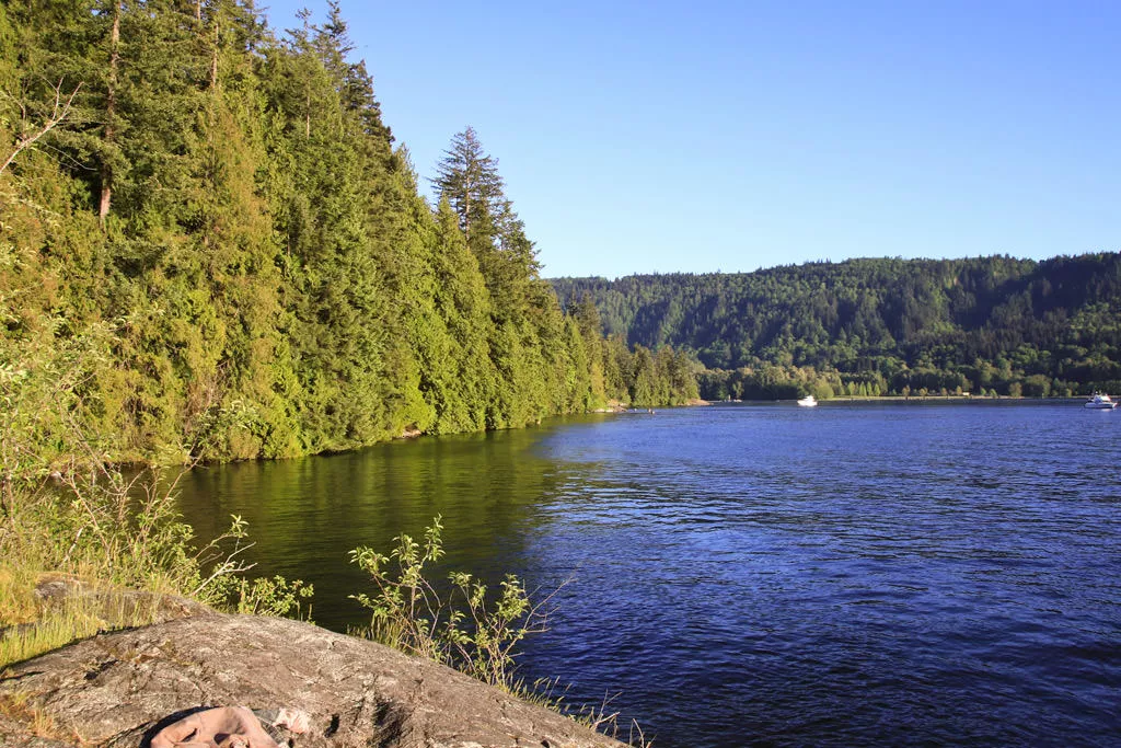
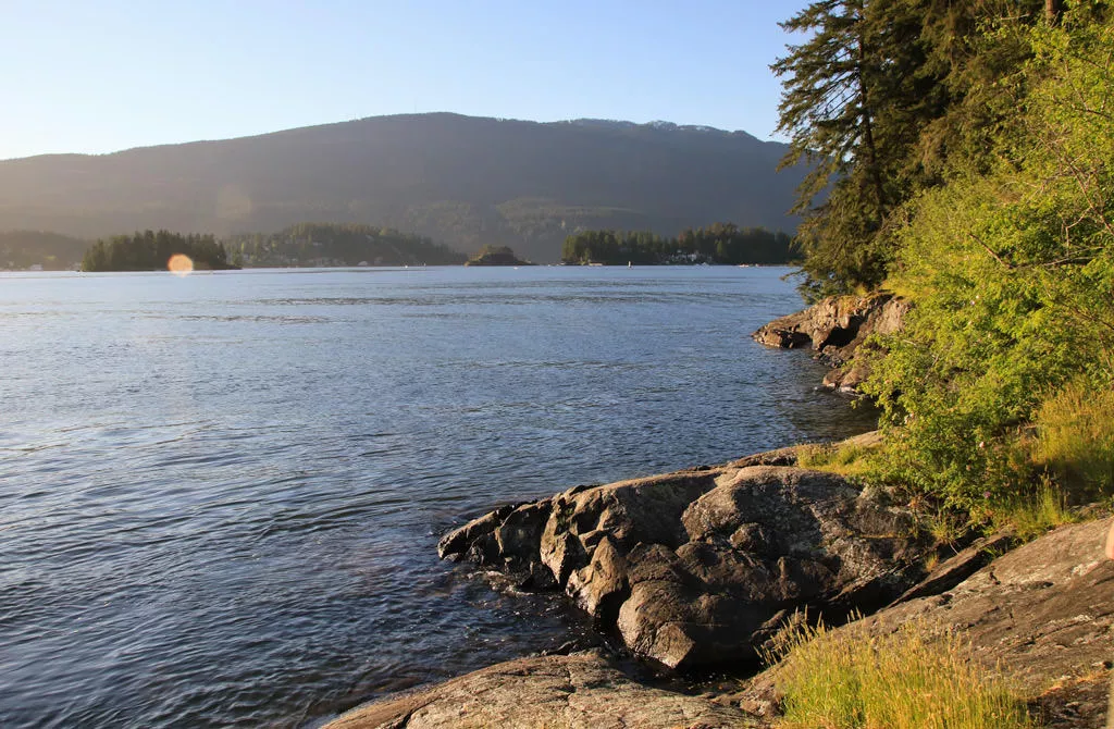
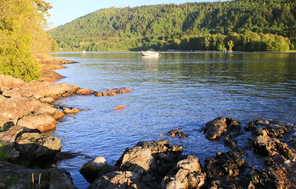
After walking another kilometer from Cod Rock, the trail reaches a junction with a sign pointing the direction to Admiralty point. Go right and follow the path about 100 meters to a rocky outcrop along the shore. You've reached your destination and this is a great spot to relax and enjoy the beautiful view of the North Shore mountains as the waves lap up against the rocks.
After enjoying the scenery at Admiralty Point, return to the main trail where the sign to Admiralty Point was. The trail continues for another 30 minutes or so to a beach area and Burns Point. The beach offers a similar view to what Admiralty Point has and is only a short distance beyond the junction. Burns Point offers a view of the waterway connecting Burrard Inlet with Port Moody.
When you are ready to return to the picnic and parking area at Belcarra Regional Park, re-trace your steps along the trail and follow the path along the shoreline.
Another hike in Belcarra Regional Park is the trail to Jug Island Beach. The trail to Jug Island Beach is a bit more difficult and both trails can be hiked in one day.

How to get to Admiralty Point
Estimated Driving Time from Vancouver
1 hour
Admiralty Point is located in Belcarra Regional Park in the quiet town of Belcarra. To get to Belcarra Regional Park from Vancouver, drive east along Hastings Street, continuing through Burnaby and merge with the Barnett Highway. Continue until you reach the traffic lights and turn left onto St. Johns Street. Drive east along St. Johns Street and turn left at the lights onto Ioco Road. Drive past the mall on the right and turn left at the 3rd set of traffic lights, onto Ioco Road. It seems strange being on Ioco and then turning left onto the same street name. At this light, going straight up the hill turns into a different street name, therefore you want to turn left and continue on Ioco Road.
Follow the road as it weaves along the shore passing many houses on both sides of the road. Turn right onto 1st Avenue and a short distance later when the road forks, go left onto Bedwell Bay Road. After passing Sasamat Lake on your right, you reach a stop sign. Turn left at the stop sign and follow the winding road up hill, passing the yellow metal gate. Continue following this route until you finally descend into Bedwell Bay and arrive at the parking lot of Belcarra Regional Park.
Note: If you miss turning left at the stop sign near Sasamat Lake, you will end up driving into the town of Belcarra. You will end up at Belcarra Regional Park, however, due to the limited space, there is no public parking available. You must drive all the way back to Sasamat Lake and turn right, following the route up and over the hill towards the Belcarra Regional Park parking lot.
View a map of Driving directions to Admiralty Point
Transit Access to Admiralty Point
Bus service is provided from Port Moody to Belcarra on bus C26. There is a bus stop next to Belcarra Regional Park. From Vancouver, you will have to take bus 160 to Port Moody and then transfer onto bus C26 to Belcarra. Please check with Translink for exact times and schedules for this bus.

Although we try to keep information as current as possible, www.vancouvertrails.com makes no warranty or representation as to the availability, quality, fitness for purpose, conditions or accuracy of the information provided with respect to this trail or trails. The information provided herein is further subject to our Terms of Use.
Comments
Add Comment View All Comments