- Difficulty Intermediate
- Time 1.5 hours
- Round-Trip 4km
- Elevation Gain 330 meters
- Season year-round
- Camping No
- From Vancouver 1 hour 15 minutes
- Public Transit No
- Dog Friendly Yes
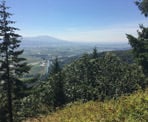
The Abby Grind is a steep hike that gains about 320 meters in 2km and ends at a scenic viewpoint looking southwest across Abbotsford. While not as steep as the Grouse Grind, the Abby Grind is still a good workout and a popular hiking trail.
The trail is part of the route to Taggart Peak, also known as the Glen Ryder Trail, however the Abby Grind ends at the first viewpoint about 2km up. Hikers wanting to continue to Taggart Peak can do so for an additional 3.5km one-way.
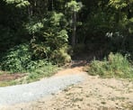
From the gravel parking lot area, the trail begins to the right by the bushes, immediately climbing up the hill. With the start of the trail being located near the Abbotsford Fish & Game Club, you will likely hear gunshots from the target range at the beginning of the trail, however the trail veers east and eventually the sounds become unnoticeable.
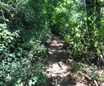
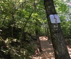
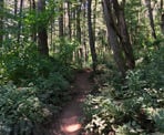
Continue hiking uphill as the narrow trail becomes slightly wider and easier to follow after the initial section. Not far into the hike, you reach a sign on a tree marking the 1/4 mark of the hike. The section just after this point levels out as you quickly make time.
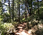
As the trail again climbs, you reach the 1/2 way point along one of the steepest sections of the route. This is a difficult spot to stop to rest, so continue up the steep section until the trail levels where there is more space to catch your breath.
Further up the trail at the 3/4 marker, the trail split into two different routes. Going right is shorter but steeper and going left is a bit longer but not quite as steep. The recommendation is to go right up the steeper, shorter route, then return via the less-steep route as it's easier to hike down. As you hike up the steeper route, watch for the trail to the left that you'll want to return on as it is not marked and appears at a corner to the left as the trail goes right.
Eventually, you reach a marked junction where the trail goes to Taggart Peak to the left and the viewpoint to the right. Go right to the viewpoint and walk the short distance to an opening on a rocky bluff, marking the end of the Abby Grind.
After enjoying the view of the Abbotsford area, walk back into the forest and begin your descent back to the parking lot. Just after passing the junction that goes to Taggart Peak, the trail veers left. Instead of going left, go straight and follow the alternate trail that is less steep and joins the main trail at the 3/4 mark. Being less steep, this route will be easier on your knees. At the 3/4 marker, continue following the route downhill as you move quickly through the gradually descending sections. Watch your footing on the loose dirt on the steep sections. Eventually, as you hear the gunfire from the shooting range, the parking lot becomes visible between the trees and you arrive back at where you began.
How to get to Abby Grind
Estimated Driving Time from Vancouver
1 hour 15 minutes
The Abby Grind is located in Abbotsford, east of the city area and north of Highway #1. The trailhead beings from a large gravel parking lot area near the Abbotsford Fish & Game Club.
From Vancouver
From the Vancouver area, drive to Highway #1 and enter the highway heading eastbound. Drive through Burnaby and Coquitlam before crossing the Port Mann Bridge and continuing east through Surrey and Langley towards Abbotsford. Exit the Highway at Exit #95 Whatcom Road.
After exiting the highway, turn left at the traffic lights and cross over the highway. Immediately after crossing the highway, turn right onto North Parallel Road (do not turn right into the freeway exit). Follow North Parallel Road as it continues next to the highway before veering away and eventually reaching a stop sign. At the stop sign, turn right onto Atkinson Road and cross the bridge where the road veers left and again becomes North Parallel Road. At the first road on your left, turn left onto McDermott Road. Drive along McDermott Road, crossing the bridge over the Sumas River. The parking lot area is the gravel area just beyond the Abbotsford Fish & Game Club.
From Chilliwack
Drive westbound on Highway #1 and take Exit #104 No. 3 Road. After exiting the highway, go right then immediately turn left onto North Parallel Road. Follow North Parallel Road next to the highway for about 5km, then turn right onto McDermott Road. Cross the bridge over the Sumas River and the parking lot is just beyond the Abbotsford Fish & Game Club.
View a map of Driving directions to Abby Grind.

Although we try to keep information as current as possible, www.vancouvertrails.com makes no warranty or representation as to the availability, quality, fitness for purpose, conditions or accuracy of the information provided with respect to this trail or trails. The information provided herein is further subject to our Terms of Use.

Comments
Add Comment View All Comments