- Difficulty Intermediate
- Time 5 hours
- One-Way 12km
- Elevation Gain 420 meters
- Season year-round
- Camping No
- From Vancouver 30 minutes
- Public Transit Yes
- Dog Friendly Yes
Trail Notice
The Seymour River Pipe Bridge will be temporarily closed between 7:00 am – 4:00pm, Monday – Friday. A detour about 1.5km up river to the Seymour River Suspension Bridge will need to be taken to cross the Seymour River.
The eastern section of the Baden Powell trail travels through North Vancouver from Deep Cove to the Lynn Valley Suspension Bridge. This section of the trail passes several scenic landscapes, from a view of Deep Cove and Indian Arm, to great canyon scenery of the Seymour River and Lynn Creek. Note that this hike has a different starting and ending point, so you will need to arrange transportation either back to your car at the starting point or through public transit.
A sign marks the Baden Powell trailhead in Deep Cove just beyond the small community along Panorama Road next to some houses. Walk up the wooden stairs to where the dirt trail begins and continue your ascent up the side of the mountain. The first section of the trail is known by the locals as Quarry Rock, a short hiking trail that takes you to a large rock with a view of the entire Deep Cove and Indian Arm area. Follow the trail as it weaves its way through the forest, gradually climbing, then levelling, crossing small wooden bridges along the route.
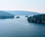
As you arrive at Quarry Rock, walk out onto the large rocky outcrop and enjoy the scenic views of Deep Cove, Indian Arm, and Belcarra and Port Moody across the water. After taking in the view, make your way back to the trail and follow the trail up the rocky hill until you reach a gravel road. Stay to the right and then go right at what looks like a junction. Take the trail back into the forest on the left as it leaves the gravel road and continues to gradually snake its way uphill.
Not long after leaving the gravel road, the trail reaches a paved road called Indian River Drive. The Baden Powell Trail continues west along this road, so go left and walk alongside the road, carefully watching for cars passing alongside the narrow road. The start of the Baden Powell trail is next to a large water tower on the opposite side of the road. Carefully cross the road and continue your hike.
The next section of trail is relatively flat with some gradual ascents, making it easy to cover quite a distance in a relatively short period of time. The forest is lush, think with douglas fir and western cedar trees as you enter into the Mount Seymour area. The trail eventually reaches the Mount Seymour parkway, where there is an outhouse for those needing a quick bathroom break. The road can be busy at times and cars are often speeding as they round the corner coming downhill, so be very cautious when crossing the Mount Seymour parkway. Once on the other side, disappear again into the forest and continue your hike.
Shortly after leaving the road, the trail reaches a 4-way intersection. Go straight and follow the rocky trail along a fairly level grade, once again, covering a fair amount of distance in a relatively short period of time, and eventually passing the west park boundary. The trail eventually reaches a junction with the Mushroom Trail. Go left on the Mushroom Trail and follow the Baden Powell markers, staying to the right and avoiding the popular mountain bike trail known as Severed Dick. For the next section, the trail descends quickly over very rocky terrain, making this a challenge to keep your balance and footing. Continue downhill for another 20 to 30 minutes before reaching another junction and go right, following the signs marking the Baden Powell trail. There are a series of trails near this neighbourhood so make sure to follow the well marked signs and watch for the orange Baden Powell markers on the trees.
The trail eventually reaches a neighbourhood road, a popular car parking area with hikers and mountain bikers looking to explore the nearby trails. Directly across the road, the Baden Powell continues in a narrow section of trail between the houses, as it wraps its way through the neighbourhood. Go left at the next junction and walk a short distance to a clearing where a trail on the right veers off and down a very steep hill towards a pipe bridge crossing the Seymour River. Cross the bridge and immediately walk up the steep steps and hillside that snakes its way to the top. Once at the top, cross under the power lines and continue to the road up ahead.
Cross the road and continue following the Baden Powell trail through the winding forest until you reach another junction. Go right at this junction and make your way downhill, descending towards Lynn Creek and a section of raised boardwalks. Just off to the left of the first set of boardwalks, there is a rocky beach area with a scenic view of Lynn Creek as it passes through a rocky canyon. Back on the trail, continue following the path alongside the creek as it gradually heads uphill until you reach the popular tourist waterfall at Twin Falls.
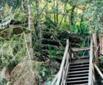
After enjoying the view, it's only a short distance to the end of this sect of trail. Continue your hike as it reaches a set of wood steps and a slightly steeper section of the trail. Once you have climbed up the final series of steps, go left at the junction with the sign pointing the way to Lynn Canyon Suspension Bridge and walk over the wooden walkways before crossing the suspended bridge, now high above Lynn Creek. On the other side of the bridge is the Lynn Valley Ecology Centre marking the end of this section of the Baden Powell Trail.
How to get to Baden Powell Deep Cove to Lynn Canyon
Estimated Driving Time from Vancouver
30 minutes
To get to the start of the trail in Deep Cove, head eastbound towards Highway #1 (Trans Canada Highway) and enter the highway heading northbound. Cross the Iron Workers Memorial Bridge, also known as the Second Narrows. Take the third exit (Exit #22) after the bridge towards Mount Seymour Parkway. After exiting the highway, stay in the right lane and immediately turn right at the lights onto Mount Seymour Parkway. Follow Mount Seymour Parkway for 5km until a traffic light at the bottom of a steep hill. Turn left onto Deep Cove Road and drive for a few minutes towards the community of Deep Cove. At the 4-way stop, turn left onto Panorama Drive and park in the parking lot or along the street. The trailhead begins along Panorama Drive on the left, past the park area.
Note: This trail is not a loop and ends in a different location than it starts. Make sure to plan and make arrangements for transportation at the end of the trail.
View a map of Driving directions to Baden Powell Deep Cove to Lynn Canyon.
Transit Access to Baden Powell Deep Cove to Lynn Canyon
This trail is not a loop and the start and finish for this trail are located in different areas of North Vancouver, so it's important to plan your day if you are taking transit.
To get to Deep Cove from downtown Vancouver, take the Seabus across to North Vancouver and at the Lonsdale Quay bus loop, take bus #239 to the Phibbs Exchange bus loop. At Phibbs Exchange, transfer to bus #212 which will take you all the way to Deep Cove.
To return to the Seabus from the Lynn Canyon Suspension Bridge, walk up past the parking area along Park Road and turn right onto Peters Road. Walk 2 blocks to the first bus stop and take bus #229 to Lonsdale Quay.
Note: These bus routes can be reversed if you plan to hike this section of the Baden Powell from Lynn Canyon to Deep Cove.

Although we try to keep information as current as possible, www.vancouvertrails.com makes no warranty or representation as to the availability, quality, fitness for purpose, conditions or accuracy of the information provided with respect to this trail or trails. The information provided herein is further subject to our Terms of Use.

Comments
Add Comment View All Comments