
- Difficulty Intermediate
- Time 6 hours
- Round-Trip 18km
- Elevation Gain 820 meters
- Season July - October
- Camping Yes
- From Vancouver 1 hour 45 minutes
- Public Transit No
- Dog Friendly No
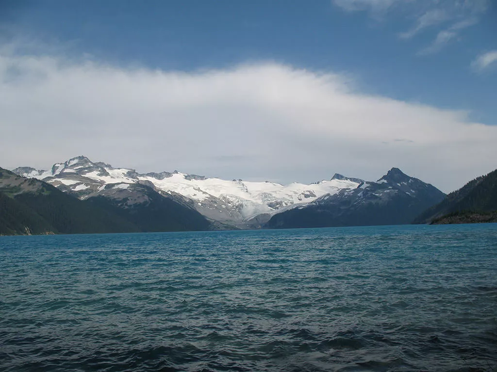
With turquoise-coloured water nestled between alpine mountains and a spectacular glacier as the backdrop, Garibaldi Lake is one of the most scenic destinations in British Columbia.
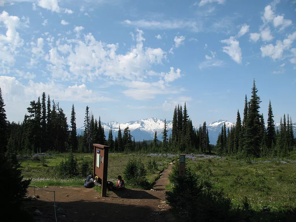
Accessible from the Rubble Creek parking lot just south of Whistler, the hike begins at the wooden steps along the top section of the parking lot. The first 6km of the trail is a gradual uphill climb through dense forests of Douglas Fir trees. At times, the trail can seem like it goes on forever, however keep moving as the reward will be well worth the effort.
Shortly after the 6km mark, you reach a junction with a map of the surrounding area. Going right takes you directly to Garibaldi Lake, the perfect option for those who may be short on time or want a shorter hike. However, going left and adding a few kilometers onto the hike takes you up through Taylor Meadows, a magnificent area filled with colours from alpine flowers that cover the sides of the trail during the late summer and early fall. At the junction, go left and head towards Taylor Meadows.
After another 20 minutes of gradual uphill, the trail begins to level and you arrive at the Taylor Meadows campsite. Looking up to the left between the trees reveals the towering peak of Black Tusk.
Continue along the trail through the meadows occasionally stopping to check out the view behind you. The meadows are very sensitive to any sort of foot traffic, so it is important that hikers stay on the marked trails in order to protect and promote the growth of this ecologically sensitive environment.
Eventually, you arrive at another main junction where you have the choice of continuing to Black Tusk or Panorama Ridge. We will save these long and difficult hikes for another day and head off to the right towards Garibaldi Lake.
The trail continues it's meandering path through the meadows for the next 20 minutes. The trail eventually begins to head downhill through a series of switchbacks offering the occasional views of the turquoise-coloured lake through the trees.
Once you reach the bottom of the switchbacks, watch for a sign and a trail that goes down a steep dirt slope. Take this path as it heads down towards the river draining from Garibaldi Lake and a wooden bridge crossing. Cross the bridge and continue to the left towards the lake. As you continue walking, the lake becomes more and more visible until you reach a wooden structure where the trees open up completely revealing a panoramic view of the entire lake and glacier off in the distance. From this point on, there are several places that offer scenic views. Pick one that is less busy and stop to take a break and soak up the view.
Once you are satisfied you have taken enough photos and are ready to head back to the parking lot, walk back alongside the lake where you came towards the wooden bridge that crosses the river. Head up the steep path to the junction but this time, go left. This trail will go directly to the first junction, bypassing Taylor Meadows.
Continue along the trail as it passes two other smaller lakes that Garibaldi Lake drains into. These lakes also offer beautiful scenery but they are not quite as spectacular as their mother lake.
After passing the second lake, continue into the forest and a short distance later the first junction appears that you passed earlier in the day. Continue straight back downhill towards the Rubble Creek parking lot. The next 6km are long but keep in mind the accomplishment and reward of getting to enjoy one of the most beautiful places in British Columbia.


How to get to Garibaldi Lake
Estimated Driving Time from Vancouver
1 hour 45 minutes
To reach the Rubble Creek parking lot, the start of the trail to Garibaldi Lake, take Highway #1 (Trans Canada Highway) west towards Horseshoe Bay. Just before the ferry terminal, watch for signs to Squamish and merge onto Highway #99 (Sea to Sky Highway) heading north. Continue driving along the highway until reaching the town of Squamish 45km later. At this point, it's a good idea to make sure you have enough gas, water, and food for the day as there are no other places to stop between here and the trailhead.
Continue along Highway #99 northbound towards Whistler for another 32km. Watch for Garibaldi Provincial Park signs on your right. The turnoff is a small, paved road on the right of the highway that is easy to miss. If you pass over a bridge with a large dam on the right, you have just passed it and will have to find a place to turn around and head back.
Once on Rubble Creek Road, continue for a couple of kilometers until you reach the parking lot.
View a map of Driving directions to Garibaldi Lake.

Although we try to keep information as current as possible, www.vancouvertrails.com makes no warranty or representation as to the availability, quality, fitness for purpose, conditions or accuracy of the information provided with respect to this trail or trails. The information provided herein is further subject to our Terms of Use.
Comments
Add Comment View All Comments