- Difficulty Intermediate
- Time 4 hours
- Round-Trip 9km
- Elevation Gain 350 meters
- Season July - October
- Camping No
- From Vancouver 45 minutes
- Public Transit No
- Dog Friendly Yes
Located on the rocky slopes above Eagle Harbour in West Vancouver lies a spectacular view from Eagle Bluffs. Most hikers access Eagle Bluffs from the downhill ski area of Cypress Mountain following the Baden Powell Trail as this route passes some other great scenery, including Cabin Lake and Black Mountain.
From the parking lot of the downhill ski area, walk towards the wooden sign board with a map of the trails around the Cypress Mountain area. The hike to Eagle Bluffs begins to the left of the map as you walk towards the Eagle Express Quad Chairlift. As you approach the chairlift, veer onto a trail to the right of the chairlift and continue to follow this trail. Eagle Bluffs is not mentioned on signage often, however you will follow the Baden Powell Trail which is marked by the distinctive "BP" trail markers on the trees.
Follow the trail and go left at the first sign as you quickly leave the area near the chairlift. At a second sign next to a bridge over Cypress Creek, go left and begin your hike up the steep hill towards Black Mountain. The trail begins to climb as you ascend quickly through a series of switchbacks. Take some time for an occasional rest by looking back at the views as you quickly gain elevation through this steep section of trail.
Shortly after a steep hill that hugs the edge of a ski run, you reach a small lake on your left. Continue to follow the well defined route as the hiking trail gradually weaves through a section with a more gradual incline. When the trail reaches a sign at a junction, go right and a short distance away lies Cabin Lake.
Just before Cabin Lake, there is a sign that marks a short 250 meter side trail that leads up to the Yew Lake viewpoint, also known as the northern peak of Black Mountain. There are great views of the Lions from this high point and, if you cross to an adjacent ridge, views in the opposite direction of Bowen Island and the southern tip of the Sunshine Coast.
Back on the main trail by Cabin Lake, continue to the end of the boardwalk and onto the trail for a short 10 minute hike to the southern peak of Black Mountain. Climbing up on the short rocky outcrop of Black Mountain gives you another angle of the Lions. This is a good place to stop for a snack but watch out for the ravens who try to steal your lunch when you are not looking.
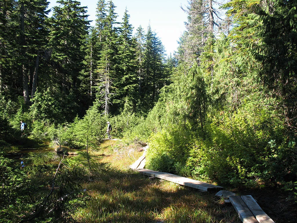
Return to the trail and continue as it begins to descend downhill through the forest before reaching Owen Lake. Just past Owen Lake, the trail arrives at another junction at which point going right takes you to Eagle Bluffs and left returns via a loop back to the junction near Cabin Lake. Go right and follow the trail to Eagle Bluffs as it passes by several muddy sections and several small lakes, including Cougar Lake. After another 20 minutes, the trail begins to descend quickly as you carefully step down a steep rocky section and into a thicker forested area.
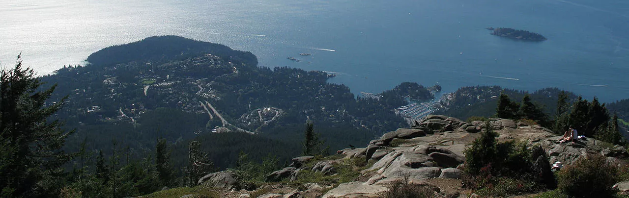
After hiking downhill for some distance, a clearing suddenly emerges up ahead as you approach the spectacular view at Eagle Bluffs. The view is breathtaking on a sunny day as the marina at Eagle Harbour can be seen below and the city of Vancouver off in the distance. On exceptionally clear days you can see as far as Vancouver Island to the west and even the snowy slopes of Mount Baker to the south.
After enjoying the view, return to the Cypress Mountain are by walking back up the same route that you took earlier. After a 40 minute uphill hike and passing back through the muddy sections, you arrive at a junction with a sign to the Cypress downhill area. Take the trail on the right, which will bypass Black Mountain, which will instead pass Theagill Lake and Sam Lake. Just after the two lakes, go left to continue the loop until you arrive at the junction near Cabin Lake where you passed earlier.
Go right at the junction near Cabin Lake and follow the route you hiked up earlier, watching your step as you walk down the trail over the loose rocks. Pass through the switch backs and stay to the right at the Yew Lake junctions. A short distance further and you will arrive back next to the chairlift where you began your hike.


How to get to Eagle Bluffs
Estimated Driving Time from Vancouver
45 minutes
Eagle Bluffs can be accessed two ways but is most commonly accessed by starting from the Cypress Mountain Ski downhill ski area. To get to Cypress Mountain, drive to Highway #1 and head westbound to Exit #8 to Cypress Provincial Park. Merge right and continue along the Cypress Parkway as it heads up to the top of the mountain. As the ski hills become visible, stay left and continue to the end of the parking lot. The trail begins beyond the lodge near the large wooden sign with a map of the trails in the area.
For a more challenging route, hikers can follow the Baden Powell to Eagle Bluffs from Horseshoe Bay.
View a map of Driving directions to Eagle Bluffs.

Although we try to keep information as current as possible, www.vancouvertrails.com makes no warranty or representation as to the availability, quality, fitness for purpose, conditions or accuracy of the information provided with respect to this trail or trails. The information provided herein is further subject to our Terms of Use.
Comments
Add Comment View All Comments