- Difficulty Easy
- Time 2 hours
- Round-Trip 5km
- Elevation Gain minimal
- Season year-round
- Camping Yes
- From Vancouver 1 hour 30 minutes
- Public Transit No
- Dog Friendly On-Leash
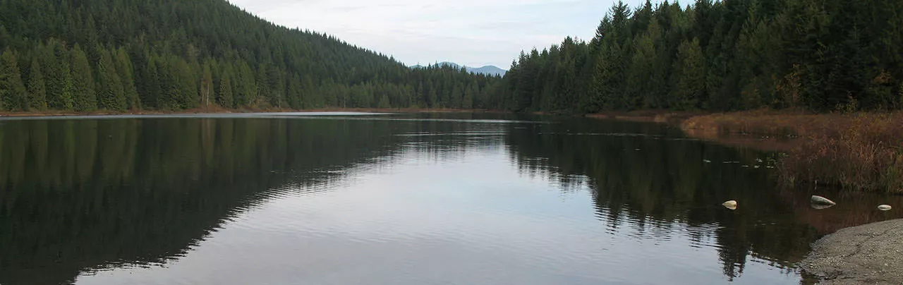
Rolley Lake is a small lake located northwest of the town of Mission. In the summer, it's a popular day use and camping area complete with picnic tables, a small beach area, and a children's playground. Therefore, the summer months are often packed with families, so it's best to go in the early spring or during the fall to enjoy a nice peaceful walk on a cool, crisp day.
During the late fall and winter season the park is generally closed so you will have to park on the paved road and walk down the wide gravel road towards the lake.
Begin your hike from the lowermost parking lot next to the lake. Head to the left to begin walking clockwise around the lake. The trail briefly enters a forest before reaching a fork. Continue to the right down the slight hill towards the lake and onto a wooden boardwalk that crosses a marsh area. From here, you can see the peaceful lake or get a glimpse of the crowds using it across from the main beach area.
Continue along the boardwalk as it crosses the lake and enters back into the forest. Tree branches are draped and the forest floor is carpeted by a layer of green moss which flourishes in the moist surroundings. The trail continues through second growth Cedar and Hemlock trees as it hugs the shore of Rolley Lake offering occasional views through the trees.
Once you reach a bridge that crosses over the rushing Rolley Creek, you are faced with the option of going left or right. Go left and follow the wide trail as it heads gradually uphill until reaching the campsite a short time later. Just a few steps further past the outhouse is another trail which leads towards the Rolley Falls Loop. Follow this trail until you reach a fork and go right as it heads down the side of the mountain. At the bottom, watch for a trail on the left and follow this as it winds through a few short switchbacks to a forestry service road.
Walk towards the road and cross the bridge, observing the falls on your left. Look for the start of a trail just past the falls and follow this trail as it heads up a steep hill alongside the creek. A short distance up you arrive at a small wooden viewing platform which offers the best views of the lower falls as they tumble into the canyon below.
After taking in the view, continue back up the trail alongside the falls as it heads back into the trees and arrives at another bridge a short time later. Here is the smaller upper falls. To return to Rolley Lake, cross the bridge and head up the gradual hill a short distance where it arrives at the fork you passed earlier. Go right and a few steps later you're back at the outhouse and the trail that heads back down towards the lake on the right.
Head back down the trail and pass the bridge without crossing it again. The trail continues alongside the shore as you make your way back towards the beach area where you began.


How to get to Rolley Lake
Estimated Driving Time from Vancouver
1 hour 30 minutes
Rolley Lake is located east of Maple Ridge near Stave Lake, approximately 1 hour and 30 minutes east of Vancouver. To reach Rolley Lake take Highway #1 (Trans Canada Highway) eastbound to Exit #44, the Pitt Meadows / Maple Ridge Exit. Stay to the right as you drive a brief distance alongside the highway and then go left and underneath the Port Mann Bridge to the stop lights. Drive straight through the lights and continue along the Mary Hill Bypass. Turn right onto Lougheed Hwy and cross the bridge towards Pitt Meadows.
Continue straight along Lougheed Hwy into Maple Ridge and turn left at the major intersection onto Dewdney Trunk Road. Take note of your odometer and continue along Dewdney Trunk Road for the next 15km, passing several strip malls before the road narrows and heads away from the town of Maple Ridge. Turn left onto Bell Street and head straight to the end of the paved road. Turn onto the gravel road on the left and continue down towards the parking areas. During the off-season this gravel parking lot is closed so find a parking spot alongside the paved road and walk the extra distance down to the gravel parking area by the lake.
View a map of Driving directions to Rolley Lake.

Although we try to keep information as current as possible, www.vancouvertrails.com makes no warranty or representation as to the availability, quality, fitness for purpose, conditions or accuracy of the information provided with respect to this trail or trails. The information provided herein is further subject to our Terms of Use.
Comments
Add Comment View All Comments