- Difficulty Intermediate
- Time 4.5 hours
- Round-Trip 10km
- Elevation Gain 500 meters
- Season June - November
- Camping No
- From Vancouver 40 minutes
- Public Transit No
- Dog Friendly Yes
With trails near the top of Cypress being covered with snow until well into July, a series of trails known as Lower Hollyburn can be hiked at a lower elevation earlier in the season. The trails pass by Blue Gentian Lake, West Lake, and First Lake before descending the less frequently used Forks Trail.
The start of Lower Hollyburn begins at the Cypress Mountain lookout point, on the other side of the curve. Park at the lookout and walk east towards the outhouse, following the road on the outside of the median around the curve until you reach the other side where a trail passes through a gate. Walk up the trail a short distance and go right and then another right as you then begin to descend into a creek gully. Follow the Millstream trail as it remains fairly level, crossing several creeks and enjoying the peaceful forest.
Eventually, you reach a junction on the left pointing to the Brewis Trail. Continue straight along the Millstream Trail, passing through another black gate and by the Log Dam junction. At the Lawson Creek Forestry Heritage Walk trail, go left and start your uphill hike, passing through a third black gate a short distance later.
Continue along the wide, uphill trail, passing the Shields Incline Railway Trail. After 15 - 20 minutes of uphill, you reach a junction with the Baden Powell Trail. Go right and follow the Baden Powell Trail under the power lines, before taking another right to continue your incline. Keep following the Baden Powell Trail by watching for the orange 'BP' trail markers attached to the trees.
The trail continues to climb as you pass the Crossover Trail and weave your way through the forest and along streams. After about 30 minutes of uphill, the trail reaches a junction with a sign. Go right to Blue Gentian Lake and a short distance later, you leave the forest and arrive at the beautiful lake, surrounded by raised boardwalks. After enjoying the scenery, walk halfway around the lake to the trail junction and go left by the sign pointing the route to West Lake. Less than a hundred meters later, go left again at the junction.
The trail continues to climb gradually before reaching another junction. Go right over the wooden bridge and wrap around before walking up a steep incline. The trail levels out on the approach to West Lake as you, again, exit the forest to a scenic lake view. This is a great place to stop and enjoy lunch or a brief snack.
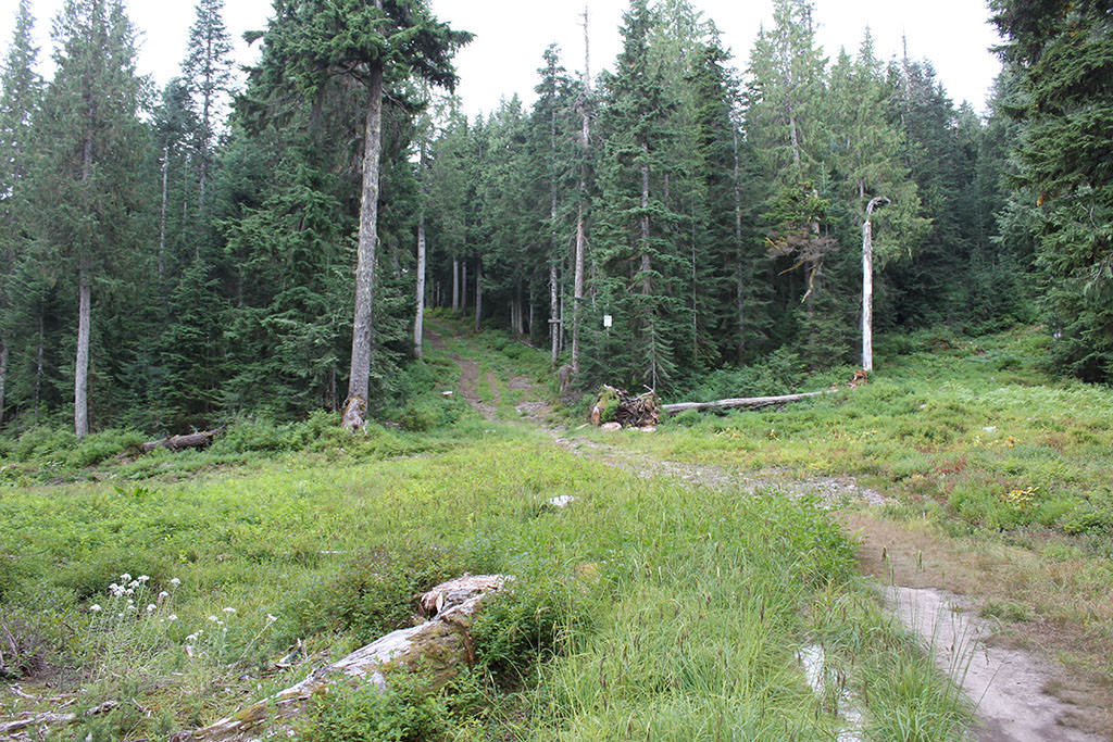
Continue your hike to the left up the wide path, passing reminants of old ski routes and ski jumping signs. The Baden Powell Trail eventually joins the trail you are on from the left, as you continue walking straight until reaching a second junction. Go left down a short gravel hill to First Lake.
Just after crossing the wooden bridge at First Lake, go left onto the Forks Trail next to the Ranger cabin. The first part of this trail is well maintained as you pass the Girl Guides cabin on the right before reaching a trail junction with a sign pointing to the left. Do not follow the arrow, instead take the trail on the right as it descends quickly over very rocky terrain, which at time feels like a creek bed. The trail passes by several other cabins before exiting on a gravel road next to the driveways of a couple of cabins. Follow the gravel road downhill and go right onto the main service road. Pass a junction to the right with a TV tower barely visible between the trees and immediately start looking for a trail on the left marked with coloured ribbon. If you reach the paved Cypress Road, you have gone too far.
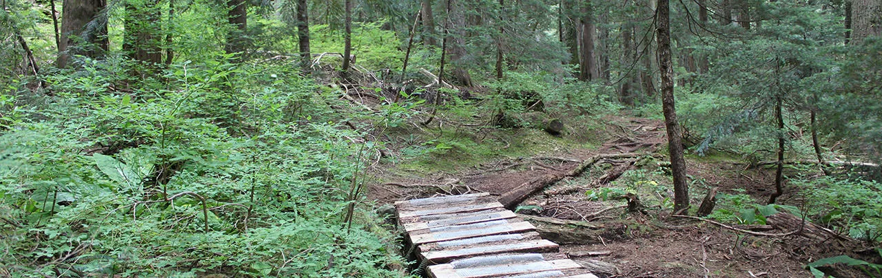
Take the steep trail down and climb over the wooden biking obstacles. The trail continues to descend until reaching a junction with the Trans Canada Trail in a clearing. Go left, briefly staying in the clearing before the trail veers to the right and continues its rapid downhill descent through the forest. Pace yourself accordingly, as the downhill section can be difficult on the knees.
Go right at the next junction and continue descending before the trail starts to level out as you hear cars in the distance driving up the Cypress Bowl Road. Go right yet again and pass through a black gate as the trail exits the forest and you find yourself high above the road and the viewpoint on the other side. Follow the trail to the left over the grass and back down to where you started in the curve of the road, before walking around the outside of the median and back to the parking area.


How to get to Lower Hollyburn
Estimated Driving Time from Vancouver
40 minutes
The hike through Lower Hollyburn starts from the viewpoint along Cypress Bowl Road. To reach the starting point, head westbound along Highway #1 and take Exit #8 to Cypress Provincial Park. Drive about 5km up the hill and watch for a parking area on the right just before the second hairpin turn. Park here and begin your hike by walking around the outer hairpin barrier to the other side of the road.
From Downtown Vancouver
If you are driving from downtown Vancouver, drive across the Lions Gate Bridge and take the West Vancouver exit. At the first light, turn right onto Taylor Way and drive up the hill and enter Highway #1 westbound. Take Exit #8 to Cypress Provincial Park. From the exit, drive about 5km up the hill and watch for a parking area on the right just before the second hairpin turn. Park here and begin your hike by walking around the outer hairpin barrier to the other side of the road.
View a map of Driving directions to Lower Hollyburn.

Although we try to keep information as current as possible, www.vancouvertrails.com makes no warranty or representation as to the availability, quality, fitness for purpose, conditions or accuracy of the information provided with respect to this trail or trails. The information provided herein is further subject to our Terms of Use.
Comments
Add Comment View All Comments