View Tunnel Bluffs Description | Add Comment
Amanda from North Van writes:
What an amazing view. We went really early this morning to get parked. Didn't seen anyone on the way up but lots of people coming up when we returned late morning. The hike is worth but get there early or do it on a weekday.
Posted: May 22, 2022 08:06:39 PM PST
rob C from north van writes:
NO free parking in lions bay at all. What used to be free parking is now metered parking, $9 for 3 hours which is what you would budget for this hike.
RIDICULOUS.
View is good but having to pay to go do a hike is absolute cash grab
Posted: May 2, 2022 09:34:57 AM PST
VanHiker from Vancouver writes:
Tunnel Bluffs is really nice hike. Did it first time when there was parking at Tunnel Point. Now we need to start at Lions Bay. Lions Bay has it's own parking problems. This hike could be combined with the easy Lions Bay Loop trail. Start at the Lions Bay store, Take the easy Centennial trail with nice view points of howe sound then turn right on the Harrison trail. Harrison will go up towards the Lions trail and connect with the trail from Sunset drive. Leave your car in West Vancouver and take the #262 bus to Lions Bay store. Another option is to stay on the bus to Brunswick and walk up the Crystal falls trail, followed by the sound view trail and Harrison trail. Enjoy the waterfalls.
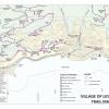
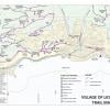
Lions bay village has its own trail map you can download in PDF.
https://www.lionsbay.ca/community/trails/trail-map
Posted: April 1, 2022 08:53:44 AM PST
Kai from White Rock writes:
Went up on Friday 4th March.
Got to the parking around 9am and there were few parking left vacant.
In and out 2:40 mins. Met 5 groups in total. Very quiet and cold. Cold snap froze all the water on the trail so it was not muddy but icy.
The view is always spectacular and we pretty much had the view all to ourselves.
Posted: March 6, 2022 07:04:45 PM PST
Faris from Vancouver writes:
Hi!
Anyone been up recently? Planning to go up March 5th, wondering if there is any snow.
Also, I'm hearing 2 different accounts on parking and the steepness at the beginning. Are there 2 different trail heads? Is there one that avoids the steep incline at the beginning?
Any insight would be great. Happy Hiking!!
Posted: February 18, 2022 04:25:10 PM PST
Spencer from Squamish writes:
Hey guys very little chance but my black and red maloja down jacket fell out of my pack at some point. Likely going under some dead fall on the way down. If anyone is kind enough to give me call if they come across it that would be appreciated! 604 815 9200!
Posted: January 7, 2022 07:02:45 PM PST
Ellie from North Vancouver writes:
1. There are probably only around ten parking stalls at the sunset trailhead parking lot (pay parking, $3 per hour). We arrived at 6:30am on a Saturday (July 10th) and luckily got the very last spot! I strongly recommend to get there before 6am on weekend as the parking lot also allows overnight parking. If the lot is full, you need to park at the elementary school below which adds 2km total to your trip
2. An extremely busy trail…. We started descending at around 9:30am, and saw more than SIXTY GROUPS of people hiking up (Friend and I were betting how many groups we would encounter on the way down, so we counted lol). We were extremely lucky that we got the view to ourself with a handful of groups of people when we were on top
Posted: July 15, 2021 09:21:41 AM PST
Ti from Vancity writes:
Bear sighting today on switchbacks. 2hrs 15 mins total up and down.
Parking full at 945 am Tuesday
One of the best payoffs in van for a short hike.
Posted: July 13, 2021 09:21:07 PM PST
Megan from Vancouver writes:
Well marked and maintained trail. Pay parking. There is parking on Mountain Dr that is less far than the elementary school. The first part is a bit rocky. Overall good hike with great viewpoint.
Posted: June 17, 2021 05:14:15 PM PST
Ron from Lions Bay writes:
To the people who are defecating on the trial and leaving their garbage, cigarettes butts, used toilet paper and water bottles behind. Grow UP !
Posted: May 23, 2021 09:39:25 AM PST
Cathy from Vancouver writes:
Did this hike on May 2nd. The view point at the end is beautiful but the trail was very busy. The bluffs were packed and during the walk back we walked past over 200 people. Nice hike but would recommend doing on a weekday if possible.
Posted: May 4, 2021 10:15:47 PM PST
Zak from Vancouver writes:
Did this hike today. What a view!! We went really early and arrived at 7:00am and got a parking spot at the elementary school. When we got back around before noon, there were lots of people waiting in their cars for a parking spot. Go early or maybe on a weekday.
Posted: April 17, 2021 04:28:09 PM PST
Jess from Vancouver writes:
Went up to Tunnel Bluffs on Easter Sunday and the view was gorgeous. No snow on the trail and the pay parking meters have been recently been installed. This was the first time I did the route from Lions Bay and it feel much easier than the old steep trail that started at the highway. A great first hike of the season!
Posted: April 5, 2021 10:04:53 AM PST
Cameron Pierce from Vancouver writes:
I had apparently always mis-hiked (or mis-designated) the true Tunnel Bluffs trail until today--having previously ascended from the Tunnel Point parking lot on the West side of Sea-to-Sky, and scrambling up what is in fact that Tunnel Point trail until it merges with the Tunnel Bluffs trail (logging road) at the horizontal traverse near the top. Now that parking at Tunnel Point (Sea-to-Sky) is eliminated by the 30-minute restriction, hikers are by-and-large obliged to take the true Tunnel Bluffs trail, starting at the Sunset trailhead (near Magnesia creek)--or at the Lion's Bay Elementary lot 1 km back, to save a dime.
The true Tunnel Bluffs hike, as I took it today, is a wide-track logging-style road (with lots of loose rocks) almost the entire way, and generally less secluded, picturesque, and technical than the Tunnel Point trail was... with a few major pay-off ocean views along the way, shafts of sunlight coming through dense tree cathedrals when the weather's fine, and a couple of nice log bridges over mountain creeks. Having said that, the vast ocean-&-island vista, the fullness of the views that will open to you on a sunny day at the summit, are breathtaking--and utterly worth the logging road that is Tunnel Bluffs.
Sunny, warm, and no hint of snow today (Nov. 1/2020).
Cheers,
Posted: November 1, 2020 06:45:36 PM PST
Sawkshi Sharma from Surrey writes:
Loved it! Arrive early, at 7am if you want parking. You can either park at Sunset trail parking lot (only 12 spots) or there's an elementary school called Lions Bay Elementary that has parking space. It's 15-20 min from the school to the trail entrance. You start the trail at Sunset parking lot and you walk up a hill for 45 mins and take a slight left turn for tunnel bluffs. After that it gets easy. Definitely worth the view and it was fun crossing the small bridge.
Posted: August 10, 2020 11:31:43 AM PST
Rohan Bandekar from Surrey writes:
Great hike. However, my car got towed along with one other car. $195. Parking in the sea to sky lot is not worth it.
Posted: July 17, 2020 05:15:45 PM PST
Cian from Vancouver writes:
Car got towed!!
My car was one of three cars towed away from the parking lot on sea-to-sky. Pretty harsh considering the parking lot is besides the trail head. However, there is a very small sign on the entrance that says '30 min parking'
It appears that is good business to tow the cars, with many pulled away in batches. The lot is privately managed and the towing company is private. Something does not smell right about that this outsourced business arrangement.
Be careful. Hopefully it doesn't happen to you.
Posted: June 15, 2020 10:09:47 AM PST
VanHiker from Vancouver writes:
Very good hike that took about 2-2.5 hours each way. There is several view points on the way up that are good rest stops. Did this hike in April 2019. Started at about 12pm and had to wait for someone to leave to get a parking spot. As of 2020, can't park here anymore. There is a new route from Lions Bay that shares the route to Hat and Brunswick Mountain.
Posted: April 20, 2020 03:13:26 PM PST
Evan from Vancouver writes:
A pretty steep hike up for 75% of it with alpine & flatter terrain at the top. The view was exceptional, probably one of the best but coming down the steep, rocky terrain was not enjoyable and pretty difficult on the knees. Wouldn't do it again but glad we did it.
Posted: May 2, 2019 07:05:13 AM PST
Lee from Vancouver writes:
Great hike. Spetacular view in clear weather and lots of sunshine, took 4 hours round trip including the 30min rest on top.
To echo some comments before, need to be extremely careful with parking. There are only 19 regular parking spot and we were a tad late to get those. Our car was towed along with several others (including a car parked on accessible) at 9:30. They don't seem to tow any cars after that time (probably not enough space at their storage), judging from the amount of other cars we saw not parked on the lots when we came back.
Posted: April 29, 2019 01:26:41 PM PST
Michael L from Surrey writes:
Nice views up top but not really much different than the views you get from Saint Marks, Unnecessary Mountain, or even the Chief. No snow as of April 7, 2019. This is not really a beginner hike, coming from a very experienced hiker of 7 years. Hiking shoes and at least one hiking pole recommended. Its first half is quite steep that is not so much a problem going up, other than being a good workout. Coming down the same way is quite harsh on your knees with slippery rocks and roots intersecting each other. Trail has really weathered the last few years. A walking pole for 3 point contact would help while going down. Even with new North Face hiking shoes with thick lugs and a walking pole, I still took a tumble coming down. My avid hiking friend also slipped coming down with walking poles and Merrill's. Saw a guy with his leg gashed open and bleeding in the parking lot. He walked it off. Crossing the Sea to Sky is another factor to be careful - cars screaming by and you really have seconds to get across. Just do this one for the credit and move onto something more interesting.
Posted: April 7, 2019 06:12:12 PM PST
Mel from North Vancouver writes:
Did this one last year and again this Saturday for a quick afternoon hike. This is not a hard hike, there’s a bit of a climb at first and then it’s flat. There’s no scrambling or any technical parts whatsoever. 1 hour and 5 mins to top and 50 mins down. Not sure re: complaints about trail. It’s perfectly marked and I forgot my boots to went up in my Reebok’s with absolutely no thread and it was totally fine. I’m used to hikes where I at times fear for my bones lol. It’s stupid busy so knowing that I went around 2 pm and it was fine. Very nice views up top
Posted: October 14, 2018 08:46:10 PM PST
Matthew Ault from Vancouver writes:
So I went up yesterday and wow, my legs are sore today! This hike is rated as intermediate but I'd say the only intermediate thing about it is the duration. The first half of the hike is brutal and pretty difficult on the way down on wobbly knees. The ascent/ descent is a good hour and a half of continuous scrambling and is highly technical. If it rained you'd be in big trouble on the descent. It was easy enough to follow the trail. The notice board at the bottom does mention that the trail is being eroded by increased traffic. There have been some rock slides near the top and there the path is loose rock so take care. There is no snow, it was largely dry and there were minimal bugs except at the top where they were manageable. Glorious views at the top and a few viewpoints on the way up. The trail is located across from the Tunnel Point parking lot.
Posted: July 20, 2018 01:57:27 PM PST
Taylor from Vancouver writes:
One of the best hikes we have done so far. Went early May. Trail wasn't very busy. Uphill for about an hour straight, then a nice little walk for 20min to the view point. Trail isn't marked out as well as others, so pay attention. Overall, would do it again. Worth the amazing view at the top.
Posted: June 22, 2018 10:07:52 PM PST
Dave Tarken from Squamish writes:
A nice comfortable intermediate hike. A good value in terms of hiking time to views. If you've done the grind, the chief or St.Marks you should be able to handle this one, but you'll need to more careful for the first half of the trail than the aforementioned trails. There are many loose rocks, slippery slopes and nice workout for the thighs. Personally I think the walking sticks would add more danger to your hike because you hands are best used to grab trees, stumps and rocks to prevent you from sliding. The second half is a very peaceful relatively flat walk along a soft pleasant trail. Most of the hike is nicely shaded so its definitively not a sun burner until you get to the cliff face at the top. There are mosquitoes but not too many as there isn't much stagnant water around. Going down will put some pressure on your knees. Use the trees to as braces as you find your grip on rocks and stumps to prevent you from sliding down the dirt and loose rocks. Beware of large dogs invading your space. We had two off-leash pit-bulls get uncomfortably close with little control from their owners. Overall I would defintely recommend the trail for moderate hike when the chief or St.Marks feels too long, but definitely keep your eyes on where your feet go, don't going when wet. There are no toilets and few areas to relieve yourself for most of the trail. Get creative!
Posted: May 27, 2018 08:56:30 PM PST
Rrj from Vancouver writes:
Reached the parking lot at 8:30am this morning. It was full. Just around 10 parking stalls.
Very disappointed. There is no other parking near by.
Posted: May 20, 2018 02:19:38 PM PST
Dave from Vancouver writes:
A decent hike, with a couple of viewpoints along the way, and only a short drive out of Vancouver.
A tiny bit of mud this time of year nearing the top, but otherwise perfectly good terrain. Took around 1h35m to reach the peak at a decent pace. It's possible to camp out at the top--saw a pair doing just that.
It does seem to get a bit busy unless you go early, so would suggest making an early day of it if you want to avoid that, and avoid having to deal with parking. Still nowhere near as busy as the more popular hikes like the Chief during mid-day though.
Be careful with the dash across the highway since there isn't tons of visibility on this curved stretch, especially on the return when the roads are bound to be busier. When starting on the trail, I'd suggest crossing near the north end of the parking lot, but on the return I'd suggest crossing near the centre of the lot. That'll give you more time to spot incoming traffic on the far lane. Take your time with it, and make sure it's safe to cross!
Posted: May 13, 2018 08:39:16 PM PST
Ron from Vancouver writes:
Such a fun and rewarding hike! The first half is steep and challenging, but worth the hike up. There are many viewpoints along the way, but the final view at Tunnel Bluff is breathtaking. Parking is very limited, so try to arrive early if you don't want to wait for a parking spot. Be careful crossing the highway.
Here is a link to a short video of the hike: https://youtu.be/izW995_4t0g
Posted: April 26, 2018 10:11:36 PM PST
May from Whistler writes:
Did this on Oct. 29th - Really beautiful and dynamic. Would NOT want to hike this in rain or just after rain as it would be a total mud slide. Mixed Terrain but 100% do-able with dogs. Semi-maintained. When you think its done, its not... just keep going. The view point at the very top is beautiful. There is a pretty viewpoint about 1/2 way up but the top top is better. NOTE: you have to cross the highway to get to the trailhead (right under the yellow road sign) so be super careful.
For us it was a "one and done" hike. Definitely do it cause its beautiful but likely won't repeat it soon.
Posted: October 30, 2017 02:51:22 PM PST
Jaspreet Sidhu from Vancouver writes:
Beautiful hiking tail with an awesome view. This is much better than st marks summit as my idea of a hike is running up raw trails (not what you find on st marks). St marks is nice but with all the recent work going up there it's becoming more of a path.
Some useful directions: Use google maps with the driving directions this takes you exactly to the trail. What isn't listed is that you should continue for about 2-3km past the hike as there is a U-turn route. Take that and head back and you'll be able to park much easier. After parking there cross the road and continue to follow it towards squamish the trail itself will be on your right hand side it is tucked away. I didn't follow the road and instead just went straight across and ended up finding the trail. I'm guessing lots of people have issues finding the start and just make their own way through the trail.
Time: 1hr:10 minutes up, 1hr:00 minutes down.
How's the trail.
The start of the hike according to random inclination measurements on my compass comes to be around 15-30 degrees (some parts will vary some will be more and others less but this was the average range I mostly saw), its a good workout if you want it to be. After starting the trail there are 2-3 smaller view points (first one came within the first 20 minutes, 2nd was around 40-45 minutes) in all honesty they aren't really worth it as there are lots of trees that block the views (still check them out if you can). Once you've gotten past the hard part the trails is relatively flat and you can really cover distance eventually you'll get to a branch point with a wooden sign, there are a few other trails that link up with this trail (I wish I could remember names but to hike towards those you'll be spending around 2 hrs according to the sign). Veer off to the left and walk for another 20 minutes and you'll eventually get to the viewpoint.
There are lots of ways around some of the steeper parts for anyone who has knee issues just take a quick second to look when you're headed down or up and you'll find them relatively easily.
Terrain: mixed (steep inclines, rocky trails, flat trails, and some brush to move through).
Things I'd suggest: wear hiking boots, trail runners, or hiking shoes (the terrain is very broken down from heavy use and weathering, rocks that seem locked in can come loose easier than you think, bug spray (near the top there were a decent number of mosquitos), about 1-2L of water is all you'll really need. and dress accordingly I haven't had any issues with ticks but they're out there. Always check yourself after the hike and during when possible.
I've added a google photos link to share some of the photos I took check them out if you'd like.
https://photos.app.goo.gl/DoAY92WzSii1bXIm2
Posted: October 3, 2017 02:38:03 PM PST
Esther from Langley writes:
Did this on Sept 13, we took 1h55 to get to the top, 1h20 to descend. Very steep in some sections but I liked that these parts were mixed in with other parts that weren't as steep. The view was gorgeous, would strongly recommend boots or trail shoes, would do again.
Posted: September 17, 2017 03:46:04 PM PST
Abel from Richmond writes:
Hiked August 17, 2017
The parking lot is shared with a highway rest stop, there is no bathroom, so go along the trail. Be very careful crossing the highway to the trail head. I suggest hiking boots as the path contains many loose rocks and gravel along steep paths. 1st half of the hike is really steep.
Happy hiking,
Abe;
Posted: August 17, 2017 11:51:23 PM PST
Andrea from Surrey writes:
Hiked Aug 14th, 2017. Arrived later to avoid the morning rush (it wasn't a Monday though so maybe it wasn't so busy). Started at 12:45 and it took about 1.5 hours to the top. First half is strenuous and gets your heart up. Then second bit is like a leisure walk in the beautiful forest. Didn't stop at the view points on the way up. Just went straight to the top. And it took the same time to go down. Was a bit slow going down cuz it was steep and loose rocks. Hard on the knees for sure. Beautiful views at top. Lots of parking when I got there.
Do the hike!
Posted: August 14, 2017 07:12:18 PM PST
Mary from Vancouver writes:
Beautiful views at the top!! But wow, the first hour is killer.
I got to the parking lot at 6am and got to the top by 8:15. The first hour is brutual as you climb straight up almost none stop. I took a few view breaks and water breaks as I climbed which got me to the top in more or less two hours. Like VT says after you get passed the second rope it's basically all flat and is just a really lovely walk. I found going down was hard, just being 5'4 I had to crouch down a lot to avoid sliding.
I went early to avoid and crowds which was a great idea as by my descent at 8:40 people coming up were saying the parking lot was full. Plus I got to be up there alone for 10 or 15 minutes before the next group came up. There were probably 50-60 people that passed me going up, so if you want to "be one with nature" go early.
If you are choosing between st marks and tunnel bluffs, both are great. I prefer the trail and terrain of st marks but tunnel bluffs has an unrestricted view of Howe sound. I wish I knew about this hike sooner!
Posted: July 8, 2017 01:50:30 PM PST
Guide To Vancouver from vancouver writes:
This is one of my favorite hikes on the sea to sky. I made a helpful video of tunnel bluffs showing you what you can expect to see on the hike and posted it on youtube. I'll drop a link below
https://goo.gl/JNfZeY
Posted: July 6, 2017 09:53:08 AM PST
crossover from Vancouver, BC writes:
Hiked this trail on 2017.07.03. No parking was available when we arrived around 9:45am. Fortunately someone pulled out after we waited for a few minutes. Crossing the highway was our next challenge of the day. The trail was steep with loose rocks and dirt. Proper footware is a must. Our legs finally caught a break after reaching the old logging road. It took us almost 3 hrs to reach the top as we took tonnes of breaks along the way. The view was absolutely gorgeous. We enjoyed every second of it. The descent through the steep sections was quite challenging. Our hiking poles were very helpful. It took us about 2 hrs to get down. The trail is obviously gaining popularity as we came across no less than 100 hikers on our way up/down. Nevertheless we will still prefer this trail over the Grouse Grind for a good workout.
Posted: July 4, 2017 12:39:24 PM PST
Thuy from Vancouver writes:
Attempted to hike this on June 24; arrived at 8:20am and no parking spots left so we went elsewhere.
Tried again July 3 and arrived at 6:50am, and we were the 3rd group to arrive at the top. Took us about 5hrs with the long break in between. When we came back down, it was very busy and the parking lot was jam packed.
There were many steep and narrow parts to this trail, making it just as difficult to go down as it was a workout to go up. There is this one steep part in particular with nothing to hang on to, and nowhere to put your feet, going up or down. Also, some narrow paths close to the ledge. Bit of a more difficult hike than some of the other "Intermediate" trails in the area.
Posted: July 2, 2017 05:37:22 PM PST
Jenn from Abby writes:
Question: Has anyone taken their dog on this trail? If so how did they find it? ????
Posted: July 2, 2017 01:00:41 AM PST
Ella from L writes:
Hiked this trail on June 28. Great workout. Gets your heart pumping if you are moving at a reasonable speed. ...actually, gets your heart pumping no matter what your speed is. ;) It's steep. Trail is quite intricate, the first half anyway. Tons of roots, rocks. Today the trail was dry and therefore very slippery. Round trip took 3h 15m NOT including break at the top. Stopped a lot on the way up.
I have an issue with those hikers who decide to do this hike, but are too lazy to drive to the overpass. Instead they turn left into the parking lot from the opposite side of the hwy. Cars driving 80-110 km/h will not be able to slow down and stop behind you, when they come around the curve and you are dead stopped in their path just because, again, laziness, rules don't apply to you or because you feel entitled. Today I watched a couple of ignorant hikers almost get pushed into oncoming traffic. For a second, when rubber was burning into asphalt, I thought we were going to have to call for help. Luckily it did not come to that. Not this time anyway.
This really concerns me.
Posted: June 28, 2017 07:35:27 PM PST
Ena from West Vancouver writes:
We hiked yesterday . It was quite slippery because of the muddy soil. The elevation was too steep , so just be careful to down the mountains . The top view was incredible and worth to hike. There is no washroom available there. Long hike we have done 6 hrs returned from the top of the view. Being enough proteins because of quite challenging . It will be better for a couple of weeks when the soil is dry and sunny.
Posted: June 18, 2017 09:00:53 AM PST
Brian from Surrey writes:
Hiked on Saturday May 27. I arrived at the parking lot at 7:55 am and there were only 6 spots left. As I hiked up I encountered a few of groups of people coming down having stayed overnight. There were many people on the trail that day - not as busy as the Chief or anything, but not that far off.
The first half of the trail, distance-wise, is pretty steep and the terrain is really quite rough and tough. There are many rocks and roots and places with challenging footing. Though never really bad, I would say the trail is not in the best condition. All of that makes it more difficult than many of the "Intermediate" hikes in this list. I wouldn't recommend this one if you are not at least a decent hiker. The last half of the distance is almost level walking along mostly very smooth trail.
Places on the trail are quite beautiful, but much is also not quite as nice. The viewpoint is spectacular, and if you're pressed for time, the viewpoint at the point that the trail goes from hard to easy (1.66 km in) is nearly as good.
Posted: May 30, 2017 10:32:16 PM PST
Ron from Vancouver writes:
Great cardio blast for the first 45 minutes. The next 30 minutes is fairly level hiking to the bluff. Lots of viewpoints along the way. Took us just over 3 hours return at a quick pace. Lots of trail markers!
Hiked up on Friday May 26 - got there shortly after 8am and there were only 3 cars in the parking lot. When we left at 11:30 am, there was only 1 empty parking spot. Be extra careful crossing the highway!
Short video of the hike:
https://youtu.be/XP1qfV_rSE0
Posted: May 27, 2017 09:23:26 PM PST
Z from Vancouver writes:
At Tunnel Bluffs on the May long weekend. A little bit crowded but enjoyable. Nice views. Steep at the beginning. Careful with the parking lot...all the spots were full when we got there around 8:30 am on the Monday...we parked in front of the bus parking and our car was towed along with 5 others (half to Squamish and half to North Van with no name/number of towing company left).
Posted: May 24, 2017 12:31:49 AM PST
H from Vancouver writes:
Great hike, although it gets pretty busy. I got to the parking lot at 9:00AM and it was already full, with several others parked in no parking zones. I ended up parking in front of the bus parking. If you're uncomfortable with parking illegally(?) then I'd suggest you get there earlier than I did.
The trail is well marked and you definitely cannot get lost. It took me 1.5 hrs up (1 hour up hill and 30 min flat trails) and ~2 hours down. It was quite steep, so I took my time and tried not to slip. The view at the top is of course amazing. At 10:30AM, there were only 3-4 other people at the peak. However, 15-20 min after, a few groups of hikers showed up.
Last thing I'd say is to be careful and courteous when crossing the highway. Cars around the bend were slowing down because they saw us hikers on the side of the road, some even stopping to let people cross. On my drive back home, the traffic at that bend caused it to be backed up almost to Horsehoe Bay Area.
Posted: May 21, 2017 10:45:40 PM PST
Nadezda from Abbotsford writes:
Great trail, somewhere has wet ground, but not too dirty.
With 7 years old kid it took 7 hours. Stick is very helpful:)
Be extra careful when you are crossing the highway!
Good luck!
Posted: May 21, 2017 09:09:45 PM PST
Miranda from Sunshine Coast writes:
I hiked the Tunnel Bluffs trail yesterday, on May 8th, which was a perfectly sunny day. My partner and I started our hike at 7:30 am, and we were the first ones to get to the viewpoint. The first part of the trail is steep and still VERY muddy and slippery. Be careful of where you step and wear proper hiking boots!! There are maybe 5 or so viewpoints on the way to the top, a couple of which had overgrown trees blocking the view, but most were beautiful. The second part of the hike was very easy and a nice, relaxing reward.
5-10 minutes after we reached the viewpoint, 7 more people showed up within about 15 minutes. After enjoying the scenery, we left and began our descent. Be very careful of the steep, muddy part heading down. My partner and I hike every day, are young and fit, have proper gear, and we both fell down a couple of times! Nothing major, but it's slick. There is loose soil in some parts, too. On the way down, I counted 117 people heading up, and this was before noon. This was our first time hiking this trail so we aren't sure if it's normally this busy, or if it was hectic because of the beautiful weather.
Overall, this hike was awesome! We had a great time, the forest was lush, and the views were jaw-dropping.
Posted: May 8, 2017 05:32:53 PM PST
Jeff Wong from Vancouver writes:
Hike this trail May 7th, 2017.
It was a super sunny day, The views are spectacular!
Trail was a little wet and muddy in sections but otherwise great conditions!
It is a steep climb up for the first 1.5 hours till you get to the old logging roads. Then you legs will thank you! It is only another 30 min. to the top from there!
Would highly recommend. Not too busy, but parking is limited!
Posted: May 7, 2017 08:32:53 PM PST
Cass from Vancouver writes:
Hiked this on May 6. A pleasant hike - some mud in sections - the first part is a grind and it was super crowded with people and dogs. Nice views at the top if you can find a spot away from the crowds.
Posted: May 6, 2017 05:11:57 PM PST
Sam F from Vancouver writes:
Hiked this on the weekend (April 30). Trail is fairly muddy and slippery still, especially coming down the steep bits. It was a lot cooler on the bluffs - fresh breeze off the snowy mountains - than in the forest. Great views, very worthwhile.
Posted: May 1, 2017 08:21:57 PM PST
Carlie Rondquist from Vancouver writes:
I love this hike.. did it again on the weekend and it was very wet and muddy (it's April duh). Lots of beautiful little waterfalls along the side right now! A lot of the trail turns into a little creek so make sure to have waterproof shoes. I saw a lot of people with nikes and I can't imagine they were very comfortable.
Posted: April 11, 2017 06:52:49 AM PST
Amy from Vancouver writes:
This is a question not so much a comment - I am looking for some winter hikes.
I know the season says that it ends on November but is this trail possible for early January? Would snowshoes be needed?
Posted: December 28, 2016 04:13:45 PM PST
Marie from Vancouver writes:
Hi, I found a pair of gloves on this trail on Sunday. If you lost your gloves on Tunnel Bluffs trail, message me 778 322 5820 and can give them to you somewhere in Vancouver.
Posted: December 6, 2016 09:41:57 PM PST
Brooke from Windsor writes:
FYI -- trail head location: if you are coming from Vancouver .. Pass lions bay (3 exits) and park in the viewpoint parking lot. The trail head can be found by walking to the north part of the parking lot, crossing the sea to sky highway to find a small yellow sign bailed to a tree labeled tunnel point. Once you walk into the forest you'll see signage. Great hike. First 2/3 were decently steep. Last 1/3 levels out. Challenging enough but enjoyable. Definitely recommend - awesome view!!
Posted: September 2, 2016 09:52:29 PM PST
Ken from Vancouver writes:
August 21 2016,
Weather, dry and warm, mid 20s
We got to the parking lot at 11:30AM and there was only 1 spot left. The trail head is easy to spot if you follow the instructions on this site.
There are a bunch of wooden hiking sticks left in a pile at the start and I recommend to pick up one of them. It's useful for this steep hike.
The first hour and a half is just constant uphill but I'd say it is easier than Grouse Grind. The next half hour is just flat and very easy. We got up to the lookout in 2 hours. The trail is very well marked and it is hard to miss the large markers nailed to the trees.
Coming back down was tricky since parts of the hike is loose gravel and rocks and is very dusty. Take your time and go slow. Crossing the highway back to the parking lot we had to wait almost 5 minutes for a clearing to run across! Fun hike, only passed by a few hikers going down.
Posted: August 22, 2016 11:10:41 AM PST
Rimsha from Vancouver writes:
We hiked on a very warm sunny day, will recommend to hike on cooler day. There is not enough trees to shade at the top. We did not see any wasp on our way.
Camping is not allowed but we noticed that someone tried to camp at the top and left the burned firewood mess.
It is not a difficult hike but just need to be careful when coming down there are loose rock/soil. The view at top is serene. There were lots of view points. I will definitely recommend this hike.
Posted: August 15, 2016 11:43:56 PM PST
Melissa from Vancouver writes:
Very steep for the first 2/3 of the hike but then very flat afterwards until you reach the end of the hike. No bugs but quite dusty from the steep dirty area. Parking is kind of iffy because it is across the highway from the trail head.... Great view though, not crowded, pretty great hike!
Posted: August 12, 2016 03:49:43 PM PST
Amanda from Richmond writes:
I really liked this one. It's really steep for the bulk of it but the view makes it so so worth it. I wouldn't call myself an experienced hiker nor a beginner, this hike was pretty challenging. There are plenty of places to rest (viewpoints) and the trail wasn't crowded at all (on a sunny saturday!!). Makes a good day trip, I highly recommend it.
Posted: July 24, 2016 01:21:05 AM PST
Khaled from Vancouver writes:
Quite a brutal hike. We went on a weekday at about 8 am in July, and we were all alone. The entrance to the path isn't very noticeable , and the sign at the entrance was written in pen and paper. There is also a wasp nest about 200m up.
Although you could argue the view is amazing, DO NOT do this hike if you are inexperienced, if it is in the rain, or if it has rained the night before. The trail is harshly steep, muddy, and rocky, which would seem to make sense since this is not a popular hike. If you are inexperienced, this hike may be too dangerous as the path is not very well laid out (ironically, the directions are very clear).
Otherwise, you might find the view at the top absolutely gorgeous. Good luck!
Posted: July 10, 2016 12:42:42 PM PST
Have you hiked Tunnel Bluffs? Share your experience with us:
Comments that gratuitously attack or demean individuals or organizations are not acceptable. We reserve the right to remove comments or any other content we deem unacceptable in our sole discretion, including removing user names and profile pictures. For our full website terms and conditions including our legal guidelines for user postings and comments on www.vancouvertrails.com, please see our Terms of Use and Privacy Policy.





Penny from Vancouver writes:
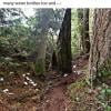
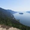
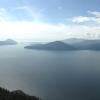
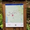
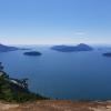
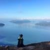
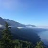
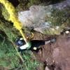
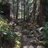
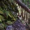
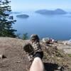
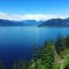
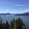
This trail is transit accessible. Take the 262 from Horseshoe Bay towards Lions Bay/Brunswick and get off at Crosscreek Road @ Oceanview Road. It’s then a 25 minute (uphill) walk to the trailhead. The first 2km of the trail are steep then after that it’s a wide, flat trail until the final approach to the bluffs, which involves a short section of scrambling. With the walk from/to the bus stop this hike took 3.75 hours.
Posted: August 12, 2023 09:51:36 AM PST