- Difficulty Difficult
- Time 12 hours
- Round-Trip 25km
- Elevation Gain 1142 meters
- Season July - October
- Camping No
- From Vancouver 1 hour
- Public Transit Yes
- Dog Friendly No
Many people are familiar with the hiking trails around Buntzen Lake like Sendero Diez Vistas, but less are familiar with a very challenging hike called the Dilly Dally Loop. The Dilly Dally Loop takes you along the Havlor Lunden Trail (sometimes called the Eagle Ridge Trail), up on the east side of Buntzen Lake, around Eagle Mountain and along a ridge to traverse Tangled Summit and Dilly Dally Peak, before dropping sharply back down beyond the north end of Buntzen Lake, and returning to the parking lot. This is a fun hike, with a variety of landscapes and spectacular views, but be warned, it is not for the inexperienced hiker. In fact, to start your hike there is a warning.
You will do well to follow this advice, and only tackle this trail with a good amount of hiking experience. You will, of course, want to be carrying all the necessary safety essentials, and be sure you have plenty of water and also a purifier or filter if you plan to complete all 25km of this loop.
The hike begins at the Buntzen Lake parking lot. Instead of walking to the beach, walk back out to the road immediately before parking lot entrances, and go into the area behind the closed gate. The trailhead is immediately beyond the gate, and there is a large signboard. The signboard has a map of the hike and gives you a nice history of Halvor Lunden, who built the trails you will be exploring today.
The trail starts off easily enough, with a gradual but steady incline. This initial part of the trail is very well-marked and easy to navigate, but before long the trail will become much steeper. There will be no respite from the climb until you reach the first viewpoint - Polytrichum Lookout - at roughly 3 kilometers and 90 minutes into your hike. From this lookout, it will take roughly another 90 minutes to reach the next major landmark - Lindsay Lake.
From the Polytrichum Lookout the trail flattens out a little bit. Shortly after the 4km point you will emerge from the trees into an open area with skies above. 200m to 300m beyond this opening, you will come to a major trail junction which is marked for "Lindsay Lake / White Rock - Coquitlam Trails". You want to follow the route marked in the direction for Lindsay Lake.
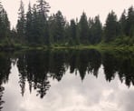
Carrying on, you will come to another major junction, named the El Paso Junction, which will split off into two directions. Here, you have to make a decision whether you want to make your way around the east or west side of Eagle Mountain. Going right (the 'Lower Lakes' route) will be the more direct route, and will take you to a series of small lakes. The disadvantage of this route is that the lakes are quite small, and this route will normally be more muddy and boggy. The advantage is, there are more blueberry bushes along this route, so you can stock up if you're feeling hungry. Going left (the 'Viewpoints' route) will drop you down around the west side of Eagle Mountain and give you several great lookouts of Buntzen Lake, the Burrard Inlet and the general landscape out to the west. This is the recommended route if it is your first time hiking the Dilly Dally Loop, and this guide will describe going this way to Lindsay Lake.
Going left at El Paso Junction, the trail will immediately cross a creek and the trail will gain and then lose some elevation as you begin to work your way around Eagle Mountain.
At roughly 5.5km you will come to a viewpoint of Port Moody and the Burrard Inlet. This is a nice, wide and open spot to have a snack if you didn't stop at Polytrichum Lookout. Just a few minutes later along the trail you will come to another viewpoint which provides an even more amazing view. From this spot you can see the Indian Arm, Deep Cove, Mount Seymour, Vancouver and the Georgia Strait.
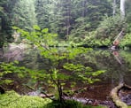
From here, there is a short downhill section to a junction marked Spahat Rigg. At this junction you can either go straight for a shortcut, or left for a quick scramble and a nice view. Going left has a short technical section, but is worth the minor detour for the scenery. The choice is yours, however, as both trails quickly merge back together. From Spahat Rigg, carry on along the trail following the markers and you will begin to pass a series of small lakes. Some are small enough to resemble ponds, however, several are very picturesque, such as Jessica Lake which you will reach at roughly 6.8km.
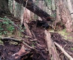
One thing you will notice on this hike, is that the trail will gradually degrade the further you go from Polytrichum Lookout. Up to Poly, its very well maintain. As you move toward El Paso Junction, you'll notice the trail is less maintained. And as you approach Lindsay Lake, there is more and more deadfall. It does not make route-finding difficult but there are sections of trail that are diverted around deadfall, or that you will climb directly over. And beyond Dilly Dally Peak and Tangled Summit, it only gets worse.
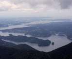
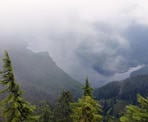
Following the markers, you will reach West Point Viewpoint at roughly kilometer 7.5. After West Point, you quickly reach two final viewpoints on this route around Eagle Mountain, and they offer the best views yet. You can see most of Buntzen Lake, and the sandy shore of its south beach. You also get a spectacular views of the Indian Arm, the Burrard Inlet, and if you look closely, even a tiny corner of Sasamat Lake below.
Keep trudging along the trail and you will finally reach a major landmark on the hike - Lindsay Lake. A great spot for a quick swim on a hot day, and to grab some blueberries before carrying on.
The trail will climb up directly from Lindsay Lake, and there is a marker that states it is 2.8km to Mount Beautiful. "Mount Beautiful" being an appropriate but unofficial name for Tangled Summit, which you will be climbing before reaching Dilly Dally Peak. From the lake it is about 1 hour to reach Tangled Summit.
After a short climb much of the next stretch of trail is relatively flat. At kilometer 8.8 you will reach Dead Tree Pass, and at kilometer 9.7, Hemlock Pass. Both are marked with signs.
Continue on the trail, following the flagging and markers until you reach Tangled Summit. This is arguably the best view you will get all day, so soak it up. In addition to the westward views you've already enjoyed, here you will get a full panorama. To the east you can see Coquitlam Lake directly below you. Beyond to the east you can see Widgeon Peak, Mount Burke, Coquitlam Mountain, the Fraser Valley and all the way to Mount Baker.
After you have enjoyed the views, it's time to carry on northward along the ridge. From Tangled Summit/ Mount Beautiful, there is a short downhill scramble. It is hard to find the markers at some spots here, so proceed with caution and with a keen eye. You should at some point find a marker that states it is 1.58km to Dilly Dally Peak, but don't worry if you miss it. En route to Dilly Dally Peak you will come to a junction for Swan Falls. Don't take this junction, as it will take you straight back down the mountain directly to the northern tip of Buntzen Lake. However, if you come this far and are very tired, or otherwise worried about getting back to the parking lot before 8pm when the gates are closed, note that Swan Falls will be your fastest way out from this point (or alternatively turning back on the route you have taken here).
Not far beyond the Swan Falls junction, at around 12km, you will come to 117 Lookout. This gives you a great view of Coquitlam Lake. From 117 Lookout, simply follow the trail along until at long last you summit Dilly Dally Peak.
From Dilly Dally Peak with you again have lakes down below on both sides of you mountains all around. Here, you will also have a view of the northern end of the Indian Arm and Croker Island.
From summit of Dilly Dally Peak, you will begin your long, strenuous descent off the ridge. There is no way of sugar-coating it - this stretch of trail is steep, overgrown, and very challenging. You will do well to not fall flat on your butt more than a few times. There is a good amount of deadfall, which sometimes runs the length of the trail, and thorny bushes will do their best to snag your shirt and scratch your legs. You have to make your way down for about an hour of this rough trail. Eventually, thankfully, the trail will open back up and you will shortly thereafter come to a creek crossing. This creek is mostly dry at the end of August, but still has water you can filter or purify if you have run out.
You will then come to 157 Lookout which will give you a view looking back south onto the Indian Arm where you can see Belcarra Bay, Jug Island, Racoon Island and Twin Islands.
The trail from here is a relic from the logging days of an earlier time in history. Lots of deadfall, and broken cement and rebar from this old logging road will mark much of the final descent.
When you come to a junction for "Croker Island Viewpoint", you are nearly back at lake-level. Croker Island lookout itself is a quick 10 minute detour and if you have the energy, is well worth it for the amazing view of the Indian Arm.
From the Croker Island junction, you have about 2 hours of hiking remaining (but it is relatively easy hiking!). You will cross the creek again and you can fill up with water if needed. There are two other creek crossings shortly after.
You will then come out to a power pylon and the trailhead for the northern end of the Halvor Lunden Trail in the small community of Buntzen Bay. Walk along the service road through and find your way past McCombe Lake to the north beach of Buntzen Lake. Now, simply follow the trail along the east side of Buntzen Lake back to the parking lot.
How to get to Dilly Dally Loop
Estimated Driving Time from Vancouver
1 hour
The Dilly Dally Loop begins from the area near the Buntzen Lake parking lot. To get there from Vancouver, drive eastward towards Highway #1 and enter the highway, heading eastbound. Drive through Burnaby and just before the Port Mann Bridge, take Exit #44 towards Coquitlam. Merge onto the Lougheed Highway and continue following it into Coquitlam until you reach intersection by a large shopping mall.
At the intersection, go straight and you are now on Pinetree Way (Lougheed Highway goes right at the light). Continue following Pinetree Way until you reach David Avenue. Turn left onto David Avenue. Follow it for about 2-3 km and turn right onto Forest Park Way, into what looks like a residential area (if you reach a school, you've gone too far). Immediately turn left onto Aspenwood Drive and follow this road for several minutes until you reach a 3-way stop at Sunnyside Road. Turn right and follow Sunnyside Road to the end, passing the gate and driving into where the parking lot is for Buntzen Lake.
View a map of Driving directions to Dilly Dally Loop.
Transit Access to Dilly Dally Loop
Taking transit when doing the Dilly Dally Loop is highly discouraged due to the trail taking so long and this bus service only having very limited hours of operation.
The Buntzen Lake area is accessible by transit by taking the 182 bus from Coquitlam Centre. Get off at the Anmore Grocery store on Sunnyside road and walk 2.4km (about 30 minutes) to Buntzen Lake.
On weekends between July and September, the seasonal Buntzen Lake Special bus 179 will stop at the north end of the first parking lot at Buntzen Lake. Check Translink's website for more information.

Although we try to keep information as current as possible, www.vancouvertrails.com makes no warranty or representation as to the availability, quality, fitness for purpose, conditions or accuracy of the information provided with respect to this trail or trails. The information provided herein is further subject to our Terms of Use.


Comments
Add Comment View All Comments