- Difficulty Intermediate
- Time 3 hours
- Round-Trip 6km
- Elevation Gain 240 meters
- Season year-round
- Camping No
- From Vancouver 1 hour
- Public Transit Yes
- Dog Friendly On-Leash
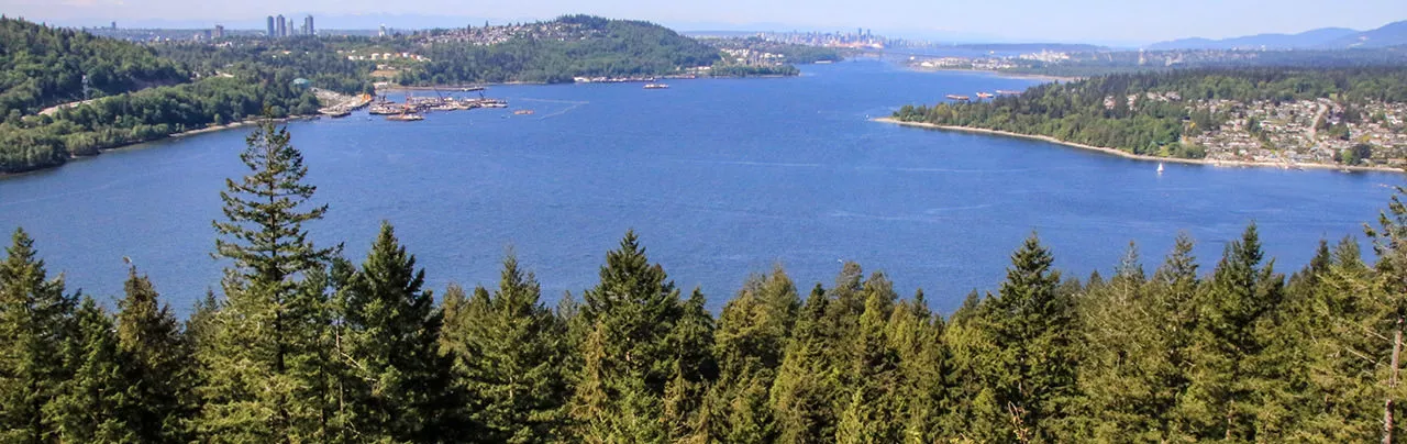
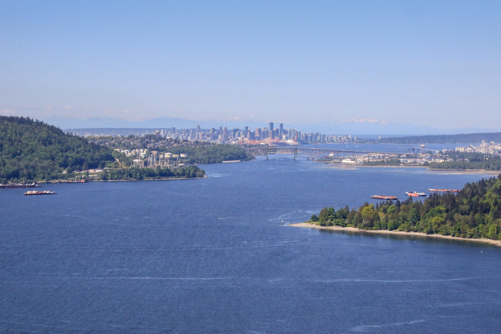
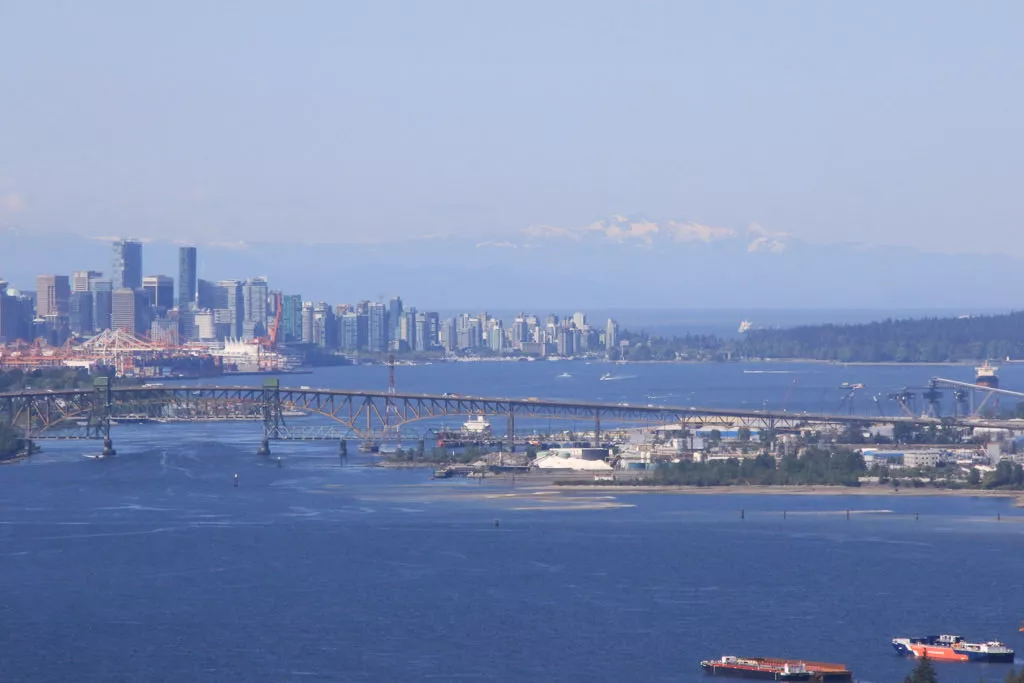
The Belcarra Bluffs viewpoint overlooks the entrance to Indian Arm, peering across towards Deep Cove in North Vancouver, to the left towards Capital Hill in Burnaby, and downtown Vancouver in the distance. The hike begins from Belcarra Regional Park and can be done as a loop, returning via the Admiralty Point Trail.
Although the trails to Belcarra Bluffs are well defined, the route is not well marked and it can be easy to miss a junction and get confused. Leave yourself extra time.
From the parking lot at Belcarra Regional Park, walk towards the left side of the building with the bathrooms. Look for a wooden sign post that marks the direction of the Springboard Trail and follow the path as it leaves the grassy section of the park. A short distance, and you reach a gravel driveway. Cross the driveway and continue on the Springboard Trail.
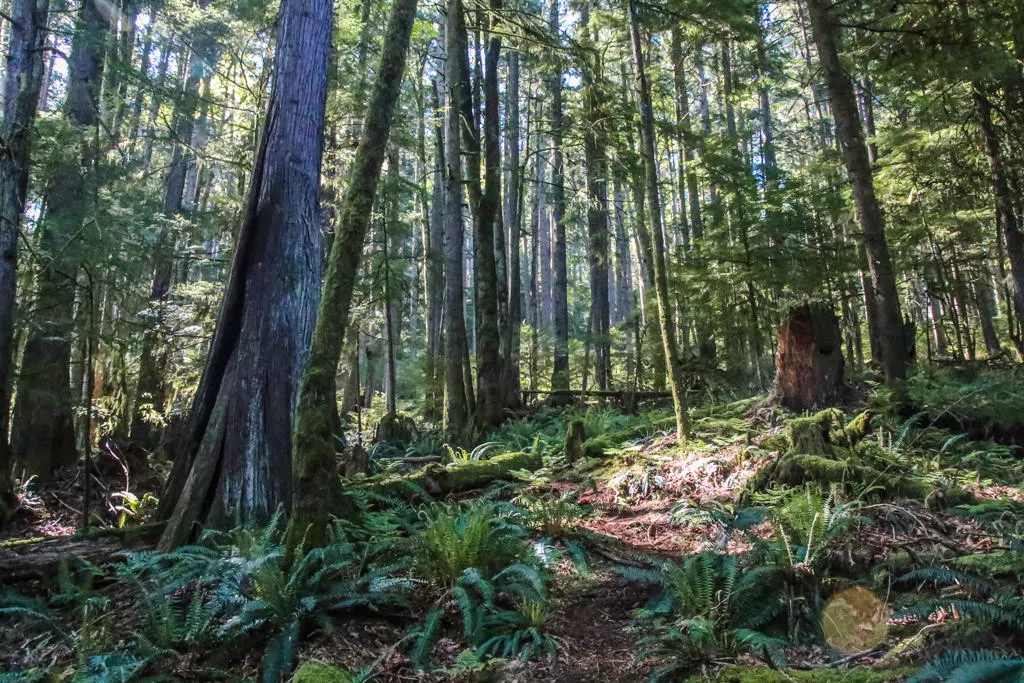
The Springboard Trail will weave through the forest as it gains elevation at a semi-comfortable pace. Count the switchbacks as you follow the trail and after passing the 3rd switch back (the 3rd one curves left), watch for a wooden park sign that marks the Springboard Trail. About 10-15 metres beyond this sign, look for an unmarked trail on the right that heads up into the forest.
Follow the forested trail as it climbs quickly. When you reach a junction, go left and follow the trail, down over some loose rocks before it veers right and continues to climb again. There are no trail markers, however the trail is well defined up until the next junction.
After walking up a somewhat steep hill, the trail will begin to level as you enter an open area of trees with minimal bushes or lower, green vegetation. Watch for an unmarked 4-way junction and go right. It's difficult to find this junction but follow the worn path as it descends slightly and you will notice the route passes around fallen trees and becomes much more defined as a trail after a couple of minutes.
The trail continues until it goes downhill and reaches another junction. Take note of this junction as you will return to this point and can take the trail to the left to descend towards Admiralty Point later. Go right and continue descending down the steep hill. The trail rounds a corner and you walk out onto Belcarra Bluffs with the incredible view right in front of you.
On a clear day, you can see the buildings in downtown Vancouver from Belcarra Bluffs. In addition, views of the entrance to Indian Arm, across towards Deep Cove and Burnaby to the left.
Return by walking back up the trail the way that you arrived until you get to the junction. Go right at the junction to return a different way via the Admiralty Point Trail. Follow the trail a short distance and go right at the first junction. The trail descends through a steep section, so be careful and watch your footing.
When the trail levels and reaches a junction, go left at the 3-way junction and continue downhill. Watch closely for a trail on the right as you descend. This junction is easy to miss and it's at a point where the trail appears to go to the left, but there is also a trail on the right. If you miss this right, you will still reach the Admiralty Point Trail but you will be further away.
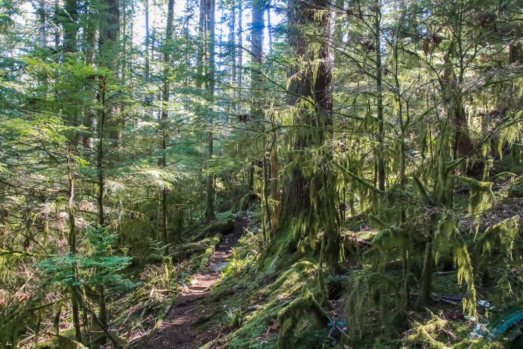
After going right at the junction, the trail passes through a section with ferns on both sides as it makes its final descent before reaching the Admiralty Point Trail. Once on the Admiralty Point Trail, go right and walk about 2km along the trail as it follows near the shoreline before returning to the grassy park area where you began your hike.
How to get to Belcarra Bluffs
Estimated Driving Time from Vancouver
1 hour
Belcarra Bluffs begins near the main parking lot area of Belcarra Regional Park. The route starts on the Springboard Trail, on the opposite side of the bathrooms building from the Admiralty Point Trail.
Drive to Port Moody and drive along St. John's Street until you reach the intersection with Ioco Road. Turn left and turn left at the 4-way intersection where Ioco continues (do not drive up the hill). Follow Ioco Road for about 4km until you reach a stop sign and turn right onto 1st Avenue. A short distance later, the road veers left to Belcarra and becomes Bedwell Bay Road.
Just after passing the entrance to Sasamat Lake, you reach a stop sign. Go straight at the stop sign to get to the parking lot in Belcarra Regional Park. Stay on the main road as it goes uphill, past Woodhaven Swamp, then descends down until you reach the parking lot.
View a map of Driving directions to Belcarra Bluffs.
Transit Access to Belcarra Bluffs
Belcarra Regional Park can be reached by transit by taking Bus #182 from Moody Skytrain Station. The bus takes approximately 40 minutes from the Skytrain Station to the Bedwell Bay at Midden Road stop at Belcarra Regional Park, where you will want to get off the bus. The stop is near the end of the route and stops right by the park's parking lot, which is near multiple trailheads.

Although we try to keep information as current as possible, www.vancouvertrails.com makes no warranty or representation as to the availability, quality, fitness for purpose, conditions or accuracy of the information provided with respect to this trail or trails. The information provided herein is further subject to our Terms of Use.
Comments
Add Comment View All Comments