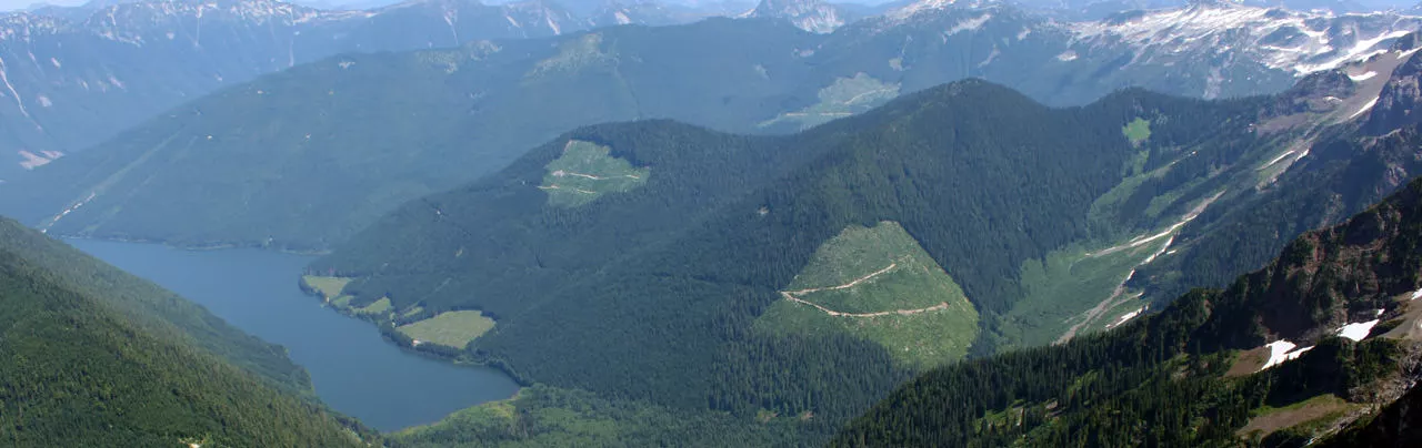
Some of the best places for hiking and incredible scenery are the alpine areas, high in the mountains along the Sea To Sky region of British Columbia. The high elevation, harsh winter climate, and geological makeup of the area give way to glaciers, bright turquoise lakes, incredible mountain top views, gorgeous meadows full of wildflowers, and rugged trail terrain, all well above the treeline.
Blog
Five Favorite Hikes in Southwestern B.C.
There comes a time when a hiker needs and even craves variety. If you are willing to go a little further afield, there are hiking gems scattered throughout the immense region of Southwestern B.C. Unfortunately, for every great hike there are innumerable lackluster, or simply bad hikes. A bad hike is especially disappointing when you have to drive a great distance to reach it. The hikes described here make the drive worthwhile almost every time.
Hiking Mount Seymour
You can’t blame a Vancouverite for wanting to get into the mountains come summer. Think about it: For six months the sun is a fiction, so when it does finally arrive in June we want to get as close to it as we possibly can, which means scads of people ascending the beautiful peaks that grace the North Shore.
Alexander Falls
One of Whistler’s most spectacular waterfalls is Alexander Falls, located in the Callaghan Valley region near the area where the 2010 Olympic Nordic events took place. The waterfall is easy to access by car and the viewing platform is right next to the parking lot, so no walking or hiking is required.
The waterfall drops an impressive 43 meteres (141 feet) over three sections and is about 12 meters (40 feet) wide at its widest point. The source of the water comes from Madelay Creek which is fed by several rivers and creeks in the Callaghan Valley region.
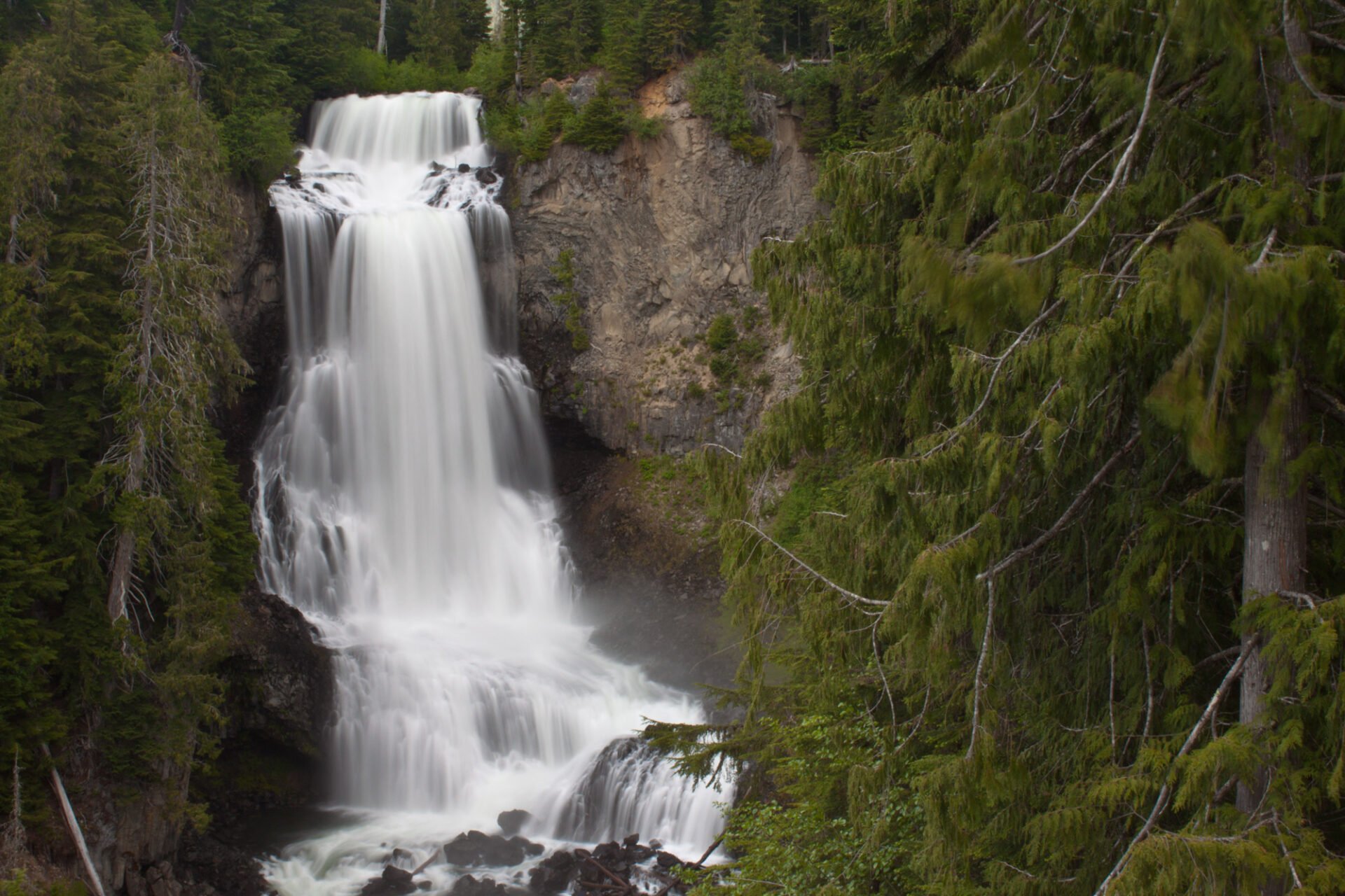
It was just before the 2010 Olympics when the area was opened up for several Nordic sports that Alexander Falls became more accessible. Before 2010, the waterfall could only be accessed by a remote forest service road and then by walking on a rough trail to a viewpoint. Now, the road to the falls is paved and access is much easier, which should lead to an increase in popularity and people driving out to see this spectacular waterfall.

The best time of year to view the waterfall is late-spring or early-summer (May / June) when all the snow on the nearby mountains is rapidly melting, providing a powerful force of water falling over the rocks. During the winter months, the water typically freezes due to the waterfall’s location at a high elevation.
Driving Directions
To get to Alexander Falls, drive south from Whistler for about 10km until you see a sign on the right to Callaghan Valley. Turn right onto the Callaghan Valley Road and follow the paved road for another 10km. Watch for signs on the left for Alexander Falls and pull into the large gravel parking lot. The waterfall is viewable from the wooden platform at the corner of the parking lot.
Top 5 After Work Hikes
If you’re a skier, snowboarder or snowshoer, then you welcome winter in Vancouver because of the abundance of outdoor snow sports that are available to us, right in our own backyard. But even the most avid of snowhounds must admit that the dark and rainy winter days can be a bit dreary. So now that the sun is finally here, why not make the most of it? Instead of waiting until the weekend, you can fit in a hike close to the city that you can do on a weekday, right after work. Take advantage of those rays while they last!
Old Home Oil Hiking Brochures
Last year, I spent some time cleaning out my grandparent’s house and I came across a time capsule of things, including some hiking trail brochures from Home Oil called the Happy Trails Collection. Being that I’m too young to remember and Google didn’t have much information, I found out from relatives that Home Oil was a gas station with multiple locations in the Vancouver area through the 70’s and 80’s. They would give out these free maps when you filled your car with gas. Apparently the maps were not just hiking trails but also maps of other BC towns and city maps for tourists.
Capilano Canyon
Capilano River Regional Park (aka Capilano Canyon) is one of the outdoor gems of the Metro Vancouver area. It’s accessible all year, it’s trails are hiked by all ages, and it’s the closest to the city where you can enjoy a west coast style rainforest within a scenic, rugged canyon setting.
Top 5 Spring Hikes Near Vancouver
The weather is starting to warm, the daylight hours are becoming warmer, and the urge to get outside has peaked. However, a lot of the higher elevation trails are still covered with snow, so what are some of the best hikes to do around this time of year?
While you may not find yourself climbing up a big mountain to take in an incredible panoramic view, there are still many great hiking trails accessible that offer a fun partial-day outing, great exercise, and incredible scenery.